
Return to main Vanishing B.C. page Return to home page
Page last updated March 31, 2005
© Michael Kluckner
|
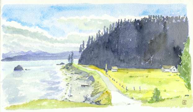
Sketched in 2003: Lawn Point is just north of Skidegate. The view looks south across Skidegate Inlet to Moresby Island, but the "lawn," with its tower and light, looks eastward onto Hecate Strait, with two buoys visible off shore. Presumably this small installation marks a shoal – can any helpful mariner explain this to a landlubber? Also, I'm unable to find any history on the site, especially how long it's been established. Note from Louis Bourcet, 2005: That lights and maker installation does not mark a shoal but rather marks the channel through the sand bar that starts in Sandspit and heads up to Rose Spit. If you take the BC ferry from Prince Rupert this is where you head to. You then turn south and follow the coast to Skidegate. The buildings may also be left over from a navigation system for aircraft flying to Japan. This channel clear if you check out a marine chart of the area. The air navigation is shown on the maps used by pilots. |