© Michael Kluckner 1998-2017
Return to main Vanishing B.C. page Return to home page
This page last updated August 15, 2019
Bits from my sketchbook along the GNR/KVR in 2000

 |
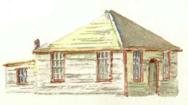
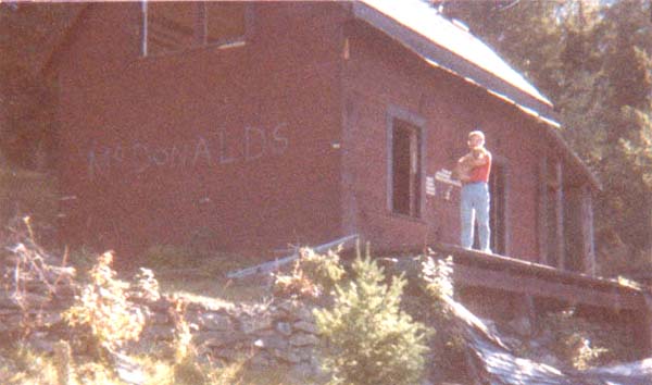
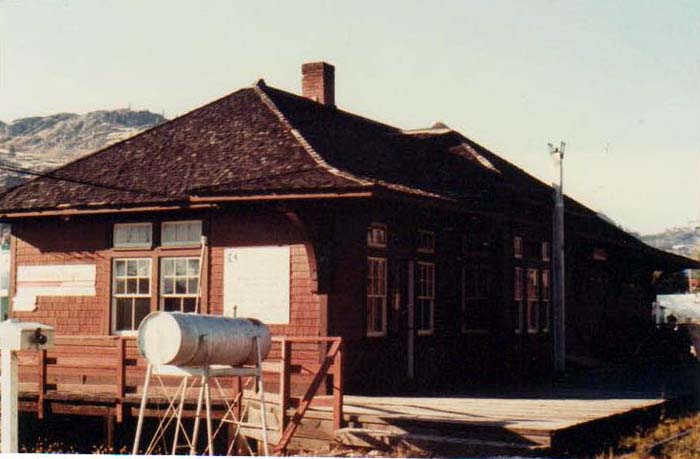
Above: the old section foreman's house at Brookmere in 2000, when it was still painted "CPR Red" – it has since been painted green and modified with shutters (thanks to Joe Smuin for clarification of the building's purpose).
Below: I was driving north along the road between Tulameen and Thynne Lake and spotted what was obviously a railway building, recognizing its hipped roof and tall windows. Before being moved to its current location it was the Manning section house, at Manning Creek, about half way between Princeton and Brookmere. |
(above) The GNR bridge crossing the Similkameen River west of Keremeos, now used for road access to Cathedral Lakes provincial park. Train service to Princeton began across it late in 1909. The bridge was damaged in the ice jam and flood following the torrential rains of the "Tropical Punch" storm of January 19, 2005.
It is very difficult to get any sense today of the scale of the railway operations in Brookmere. The right-of-way, now part of the TransCanada Trail, seems to be just an impossibly narrow slit through the forest. The village of Brookmere, which once boasted in addition to the railway operations a hotel and numerous commercial facilities, is now just a straggle of small buildings, many of which are unrestored cabins, along the roadway. There is still an unfortunate number of junkpiles and old cars, but some paint-up/fix-up activity is beginning, and hopefully new owners will fix up the old places rather than build new ones so that the village retains some of its remaining historic character. The Brookmere station and roundhouse survive only in photos.
In the years between the end of passenger service in 1964 and the opening of the Coquihalla Highway (Highway 5) in 1986, Brookmere was quite remote, but is now easily accessed from the highway at the Coldwater Road exit. It is possible to see the old railway roadbed from that point, as it makes "The Loop" – the point where the railway ended its northerly climb from Princeton and headed southwesterly, upstream along the Coldwater River toward the Coquihalla Pass and eventually Hope.
(A complete history of the GNR and KVR can be found in Barry Sanford's McCulloch's Wonder.
An abridged history is published in my Vanishing British Columbia)Notes from Neil Roughley, 2003: "From what I know, there are only 7 GNR stations left in British Columbia: White Rock (the second station, built 1912), New Westminster (the third station, built ca. 1958 and the only one still in use by the BNSF), Tulameen (built ca. 1914), Princeton (built 1909), Salmo (the second station, built 1923, but the first of GNR design since it did not build the original line), and Kuskonook (built ca. 1899). In the 1980's the Similkameen station (built ca. 1907) near Cawston was sitting in a field along the highway; it may still survive today." And, "the GNR building at Colebrook was a section house."
"The Manning section house was built c. 1914."
***
From Marcus Eder, 2019: I just drove through Brookmere along the Brookmere Road and stopped to have a tailgate breakfast by the old water tower. Originally from North Vancouver I now live in Salt Lake City. Seeing old parts of BC and reading about the history along the way is somehow comforting to me.
***From Don Allemeersch, 2017: Henry Allemeersch, my father was the lineman for the Kettle Valley railroad. I believe we moved to Brookmere in 1956 or 1957. My Dad was stationed there, transferring from Glacier. We them moved to Hope in 1959. My Dad continued working through the Kettle Valley even after CP removed the rail line. He was issued a Van with a portable speeder that dismantle to fit in the van. CP had gates at both ends of the line to keep trespassers out. Once all the telecommunications was removed my Dad's coverage was Agassiz to Spences Bridge. I, like Larry also worked for CP.
From Betty-Ann Ray, 2015: My Dad, Bill Hooson, owned the Brookmere store from 1944 to 1952. I did all of my elementary schooling in Brookmere along with all the CPR kids. We had a fun life there. In 1952, tragically my mother died and we moved away. I still have many memories of our life there and have been to the Brookmere reunion.
From Larry Mikulasik, 2013: My father was a foreman who worked in Brodie in the nineteen forties. He married late in life and while I was born in Vancouver, as a baby I lived in Brodie for a year. After a year my father moved to Brookmere and we lived in the section house. We moved from Brookmere to Hope in 1958. After the major slides in 1961? my father basically was a watchman for the Kettle Valley on the western section. Once the rails were taken up he then worked on the mainline.
I had a summer job in 1968 working on the telecommunications gang and worked through Brookmere. (The job taught me to get an education and I became a teacher.) In 2010 my friends and I did a bicycle trip through from Brodie to Spences Bridge. My parents donated some photos which are now in the museum in Penticton.
From Jocelynne Brunet, 2012: We own one of the Brookmere houses that were moved to Merritt, B.C. I believe these homes were moved to Merritt in the 1960’s. We are actually trying to find out the year that our house was built – we’ve been told they were built in 1953. Do you have any information on this?
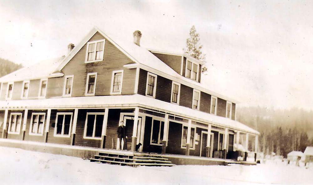
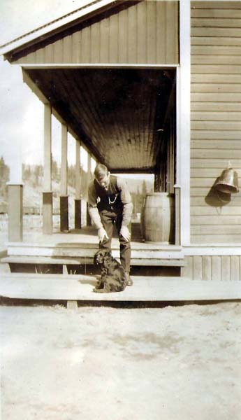
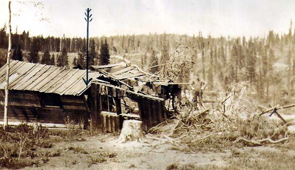
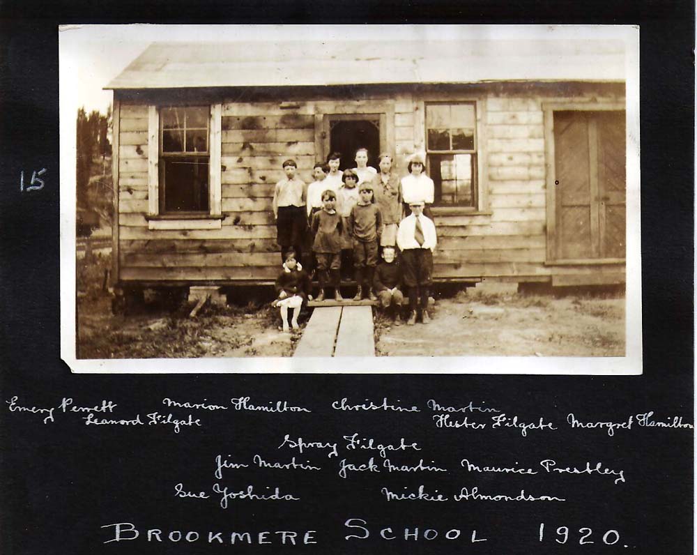
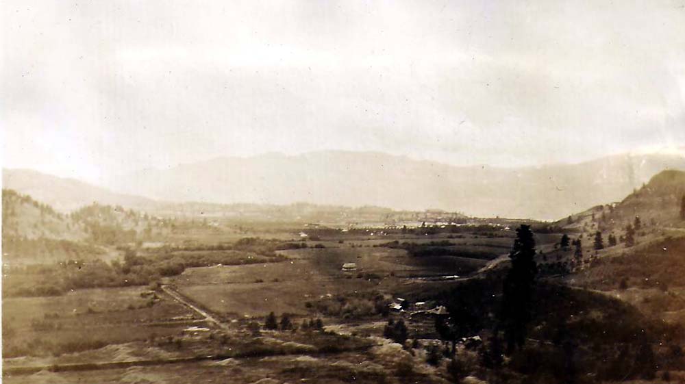
From Jon Perrett, 2011: Below are photos of grandfather Henry and father Emery. Henry Perrett ran the Brookmere Hotel in the late 1910s. His earlier time in the Kootenays is illustrated on the Beaton/Comaplix page.
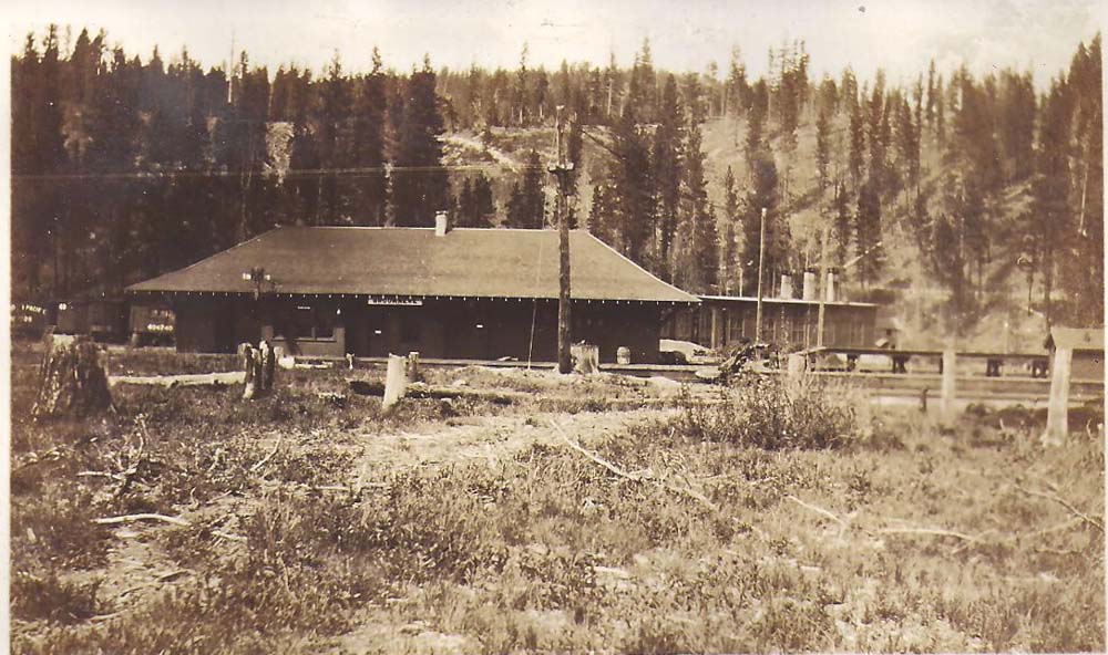
Brookmere Station in 1919
Two views of the Brookmere Hotel, 1919–1920
Above: Henry Perrett at the hotel
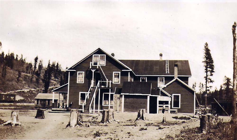
Below: Laundry of Brookmere Hotel. Mrs. Perrett was in it when a windstorm blew a tree onto it. She escaped through the hole shown by the arrow.
Brookmere School class in 1920
View of Summerland from the KVR, 1920
[end of the Perrett photos]
***
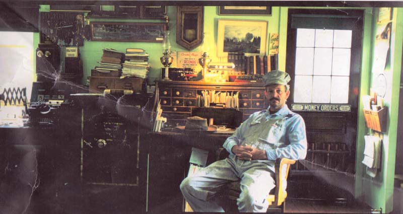
A photo of Harry Fontaine sitting in the Section House at Brookmere, from Don who now owns it.
| From
Mike Jackson, 2011: I am a long time resident of
Brookmere and I was enjoying a few photos on your site. The photo
of Harry Fontaine was likely taken in the late 1980's (not the
50's). I knew Harry quite well and he was a talented decorator
when it came to his hobbies, one of which was railroad
memorabilia. This is evidenced by the photo. The other photo that interested me was the one of the hotel. I have a photo of it burning in, I was told, 1937. I was also told that the linen and the cutlery were saved before the structure burned. Not at all suspicious. My mother and father in law were Til and Harry Percival and they were transferred by the CPR to Brookmere in 1940. Harry was an engineer, starting with the KVR in 1923. He wasn't enamoured of the railroad or the buffs, but he sure had some interesting stories. |
| Note
& photos from Les Murphy, 2010: My parents, Jack and
Katie Murphy along with partners Russ and Leona Coburn bought
property in Brookmere in 1979 from previous owner Jim Shear. These
12 acres contained what was left of Brookmere's railroad yard. The
Brookmere station was moved and converted into a duplex, it was
used as our weekend residence from 1979 until it burned down in
1986. My father, Jack Murphy (with lots of help) moved the station
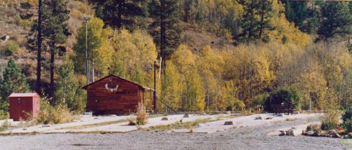
off the CPR right of way to the old roundhouse foundation. The CPR threatened to demolish the Brookmere water tower unless it was moved from their right of way as well. My dad single handedly moved the tower to it's present location around 1987. I can remember climbing around inside the water tank as a teenager. The inside of the tower had to be removed to make moving it easier. I have a bed made of the clear cedar boards that formed the tank. I also know of at least 3 sundecks around Merritt made from that wood!   ***
***
Note and photos from Don McKay, Surrey, BC, 2007: Most of the pictures [below] I bought at a Train Meet and were taken by R. Mitchell. I have some of my own but haven't come across them since I moved. I lived in the same place for 53 years and moved from three bedrooms with a basement to a two bedroom rancher so I have stuff boxed that I am still finding places for. |
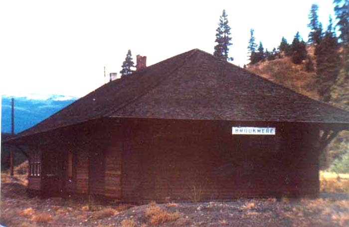
Brookmere Station (demolished), a classic simple GNR design. Photo R.Mitchell, date unknown
Foundations of the Brookmere Roundhouse. Photo Don McKay
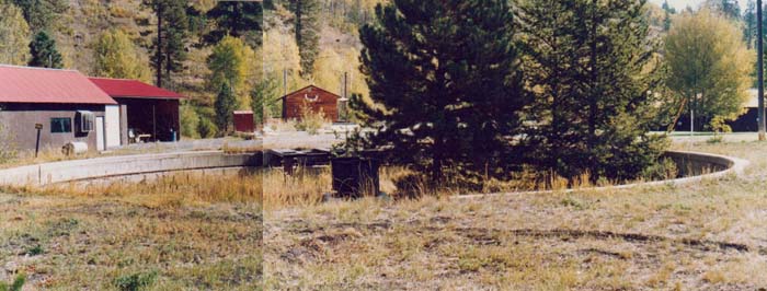
Remains of the Brookmere turntable. Photo Don McKay
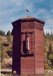
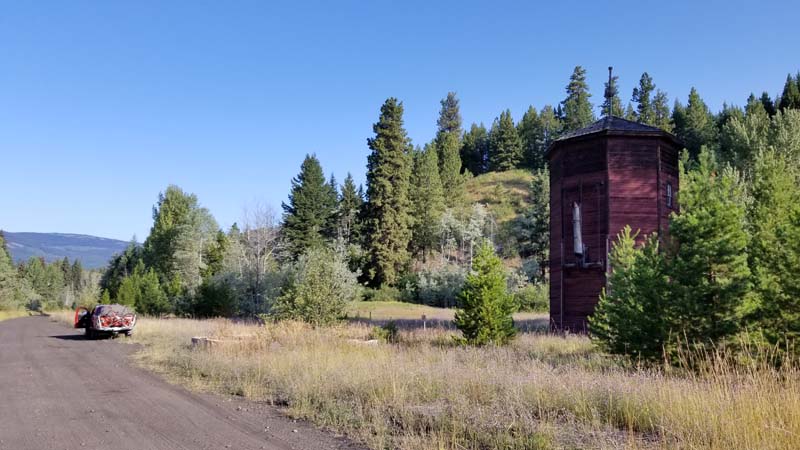
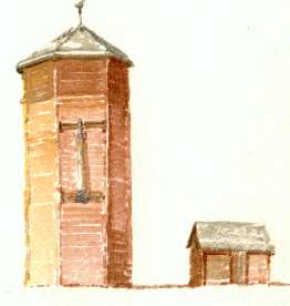
Brookmere water tower. Photo Don McKay
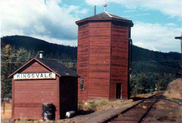
| Kingsvale
(demolished), where the KVR met the southbound spur line from
Spences Bridge in the mountains north of Brookmere. Photo by R.
Mitchell, date unknown From Ross Hodge, 2012: Kingsvale was on the spur line out to Spences Bridge, but the location where this spur met the main line is more accurately illustrated in the following picture at Brodie, which is about 12KM south of Kingsvale. I’m not sure what Kingsvale’s purpose was, perhaps an access point for the locals since the Coldwater road crossed there. |
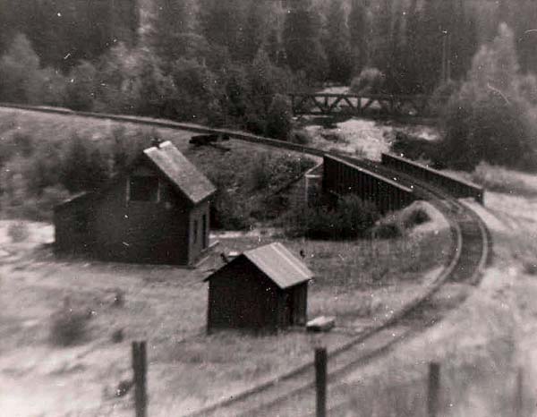
| "Brodie on Brodie
Loop Junction for continuing down the Coquihalla to Hope or Loop
back to/from Merritt and Brookmere. Another bought picture
with no date or stamp. Building unoccupied and someone
took out the upper window." -- Don McKay. Everything has since
been demolished. The loop is clearly visible as a pathway, as it
were, from the Coquihalla highway. From Larry Taylor, 2012: I once wrote to you with regard to your paintings of some of the places I once visited or lived in quite some years ago. Two such Places were North Bend B C, the other, Spences Bridge where I once lived back in 1929. I was especially interested in a photo of Brodie B.C. It never had the status of a community, [only the] section foreman's house, a bunkhouse where three or four section workers lived, and a tool house. That is how I remember it. My grandmother (who was married three times ) was married to Manual Alvarez who was section foreman at Brodie. I lived there for a short while in 1935. At the time there was a total population of six in Brodie. I especially recall the long walks with my grandmother on the tracks, toward Merritt, towards Coquihalla, and towards Brookmere, When the trains went past the whole house shook. My grandmother taught me how to catch fish with a fly (catching fish there was very easy then). When there were no trains it was a very quiet, peaceful place. I once worked on the Kettle Valley Line, from Merritt to Rock Creek, B.C., in 1940. I will be 89 years old in January. |

Princeton Station (now a Subway restaurant). Photo by R. Mitchell, date unknown
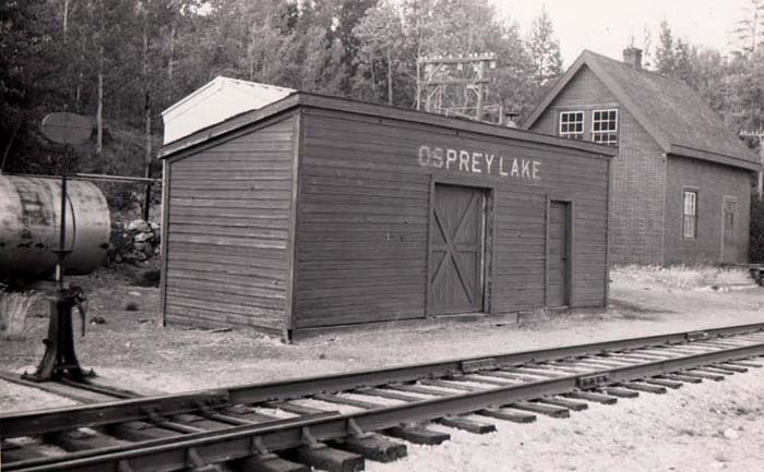
| A photo in Don McKay's collection stamped "Stan Style May 1960." Osprey Lake is the middle of the 3 lakes on the high plateau between Princeton and Summerland. I recall the water tower still standing there in the early 1980s when we had a cabin on Siwash Creek, not too far away, but everything's been demolished since. |
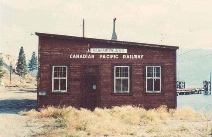
The freight house (?) along the lake at Summerland with the
paddlewheeler dock in the background (demolished).
Photo by R. Mitchell, date unknown
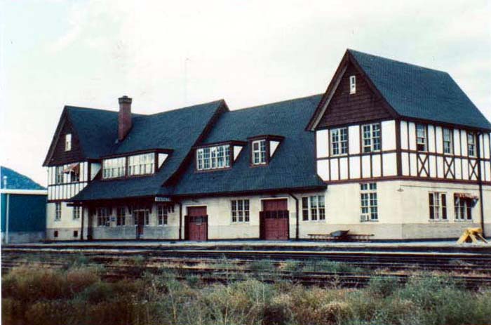
Penticton Station (extant). Photo by R. Mitchell, date unknown
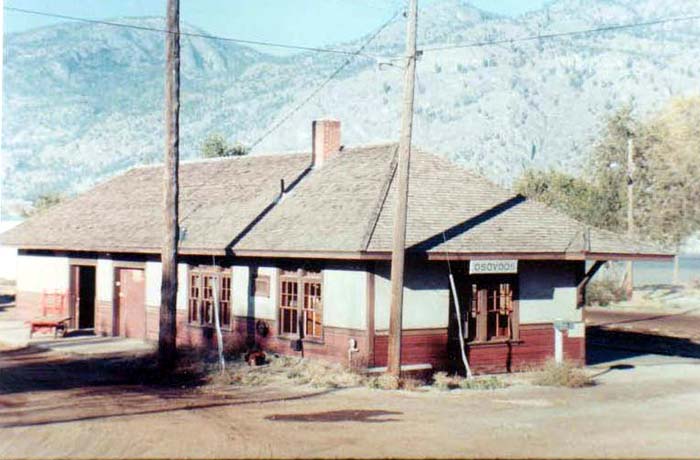
Osoyoos Station (note from Richard: moved about 300 metres north of its original position and is used by a sailing club). Photo by R. Mitchell, date unknown
Myra Canyon Station/Section House 1980s. Photo by Don McKay
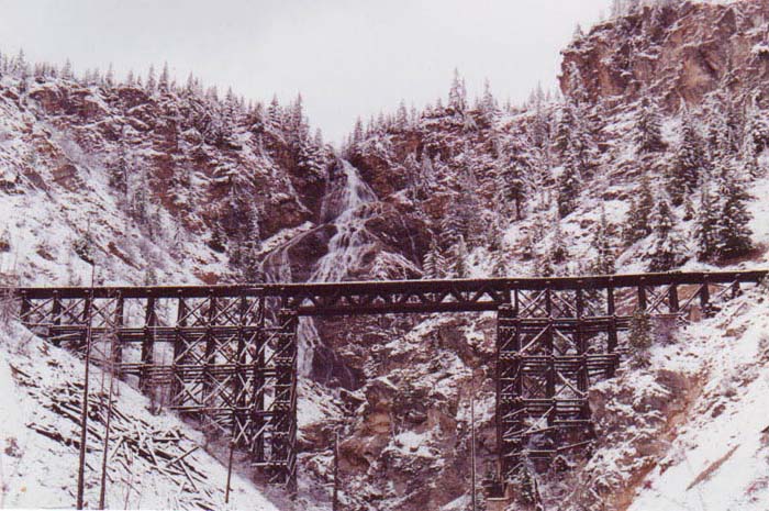
On the Coquihalla section of the line, Bridal Falls trestle after a spring snowstorm. Photo by Don McKay
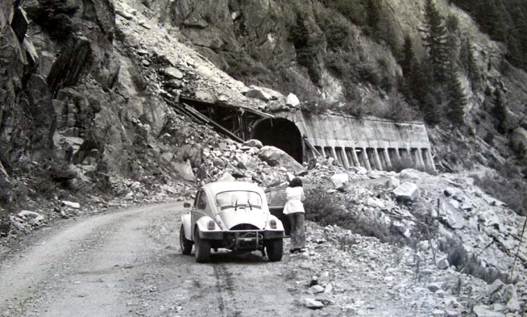
On the old Coquihalla Road, 1978: Christine, my Baja bug and a ruined snowshed. Photo by Michael Kluckner.
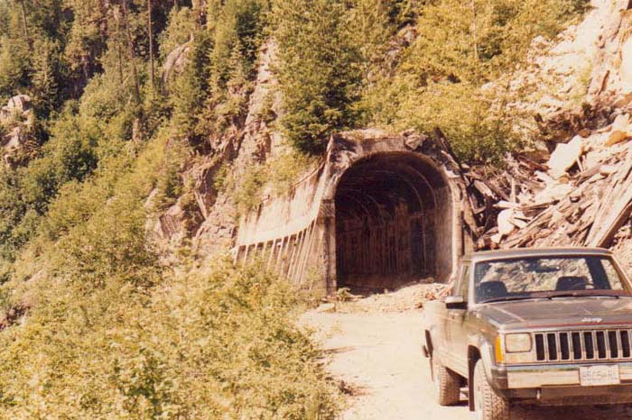
The snowshed more recently. Photo by Don McKay
| A final photo from
Don McKay's collection, location unknown although he guesses it
might have been the one at Oliver. Can anyone confirm? From Joe Smuin, 2012: Your ‘unknown’ station building is indeed Oliver, BC. I have the same image, it dates from somewhere around 1969 or probably later. Note from Rick Kwitkoski, Sorrento, 2009: The hills in the background are very much like the ones to the west of Oliver and then this photo is looking to the north-northwest, thereabouts. If this is Oliver what is the season? It looks to me like there is some snow on the hills in the background. That would make the time of day later afternoon by the way the shadows are laying across the platform on the east side of the station. The Oliver station has been made over into a tourist information centre. The railbed behind it is a walking path and a municipal campground is behind that. We moved to Oliver in September 1972 and the spur line to Osoyoos still had trains running on it then. Short ones. My father had purchased an orchard just south of town and right above the railway line. We enjoyed the trains. The tracks south of OK Falls to Osoyoos were some of the first to be removed. It was sad to see them go but then, I was off to University and not too nostalgic about stuff at that point in my life. |
| Note
from George T. Foster, 2009: I'm a writer in Seattle who
is researching the Vancouver, Victoria and Eastern
railroad (part of Great Northern system) of a century ago and
one of its earlier proposed routes up the Tulameen River and
through the mountains to the Coquihalla River and downstream to
Hope and on to Vancouver. Where the tunnel was proposed (and even
perhaps started) remains a mystery, at least to me. Old issues of
the Similkameen Star
give the location as Eagle (now Britton) Creek, but that seems
unlikely given the terrain, while others say it is farther
upstream on the Tullameen, perhaps up what some maps refer to as
Railroad Creek. Of course, the VV&E eventually made an
agreement with the Kettle Valley (CPR) to share its track over
Coquihalla Pass via Brookmere. A 1973 Canadian Energy, Mines
and Resources map shows that before the Coquihalla was built, a
highway was proposed from Hope up the Coquihalla River and
around or across Tulameen mountain and up that river to Princeton
and beyond. Does that ring a bell? Any information would be
appreciated. Thank you. Note from Archie Pateman, 2009: Just wanted to let you know that I wrote and recorded a song with my band The Breakmen based on Brookmere BC, and it is currently getting some terrific international radio play as part of our new album, When You Leave Town. The song loosely evokes some of the town's history and is in a country music format (true Merritt style!). www.sonicbids.com/thebreakmen |