Return to main Vanishing B.C. page Return to home page
Page last updated July 14, 2026
© Michael Kluckner

|
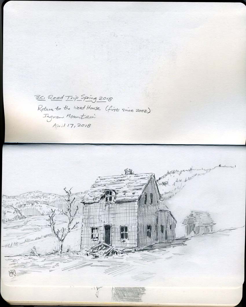
Written/sketched in 2003: On Ingram Mountain east of Rock Creek, the treeless slopes ascend almost to heaven. I had heard from a few local people about an old ranch once owned by the Weed family, and seen a blurry picture taken with a telephoto lens of a very old two-story house on an open, golden hillside. "It's on the hill above the Rock Creek golf course," I was told, "if it hasn't blown over or burnt down." I stopped on the roadside and scanned the skyline to the north. There were a few scattered properties on the hillside but they looked to be relatively new. Higher up, there didn't appear to be anything other than some scattered clumps of bush – small aspens and saskatoons in hollows on the hillside. But the more intently I looked, the more it appeared that one clump had a definable point to it, the intersection of two straight lines. So I set off driving up the mountain, taking first a wrong turn that took me a long ways toward Rock Creek with the road never doubling back. Retracing my steps, I backtracked along the highway and found Ingram Mountain Road, and followed it up through the meadows on numerous switchbacks before arriving at a dead-end – the house then of Wendy and Mark Tossavainen. I hiked another kilometer further up the hill along a grassy footpath, in an isolation so splendid it took my breath away, to find the ruins of the Weed Ranch. The sketch above looks more or less west, along the valley formed by the Kettle River. Rock Creek is in the middle distance, a couple of thousand feet of elevation below. It's an entirely separate world on these high meadows, a grassy Atlantis cousin to the world below along the highway, with birds fluttering in the bushes and harvesting the seedheads, the only sound the breeze ruffling the tall grass. There were cattle in the distance, grazing among the ruins of the Weeds' barns and sheds like the goats seen by Shelley and Byron when they visited Rome. |

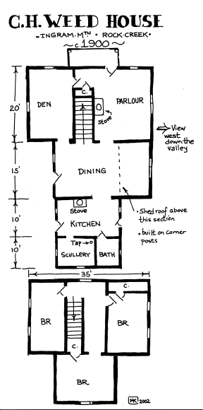 |
The house was built about 1900 and obviously sited, unlike typical pioneer ranches, in a spot intended to maximize the view. A bit dangerous to go into, but the house was built on corner posts above a dirt crawl space – not too far to fall – and the staircase seemed solid. Nevertheless, you develop a technique when entering abandoned houses of walking along the nail lines, playing the odds that there's something relatively solid below. There's no rot in this climate: buildings weaken because the boards dry out and shrink away from their nails, and eventually they shear and collapse sideways in a wind like a house of cards, rather than collapsing inward due to the failure of their dimensional lumber. In fact, the wood was dry and utterly free of paint, so weathered as to be almost petrified. What colour might it have been painted? It hasn't been lived in since the 1940s or 1950s. Sources: Boundary Historical Society, 7th report, 1976, and conversations with Alberta Bubar in Midway. [historic pictures of the farms there appear in my book Vanishing British Columbia]
|
| From
John Hibberson, 2026: I have many photos of the Weed
Place taken over a period from the 80's to early 2000's. I'm
at work presently doing the research for a novel using it as the
base. When I first started teaching here in '73, at the
2-room school in Kettle Valley, I discovered that my custodian
grew up there. As a child she and the other children there
would walk down to the even smaller school on Ingram flats.
Going back up was the toughest part! I'm a long-time photographer of both B&W and colour who spent many happy hours in my lab. Here's few "artified" samples I originally took in film for your pleasure. 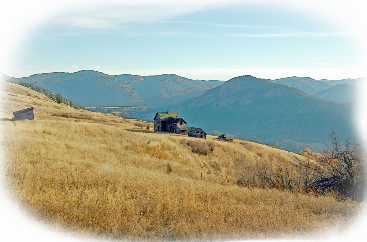 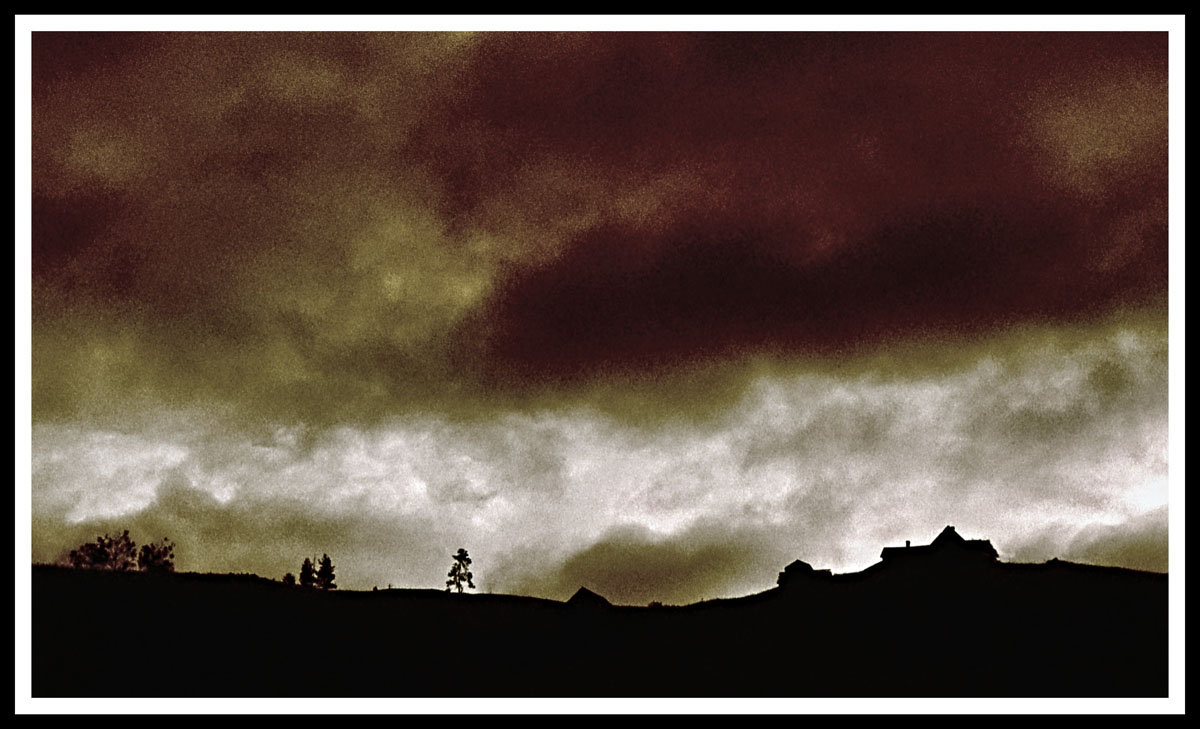 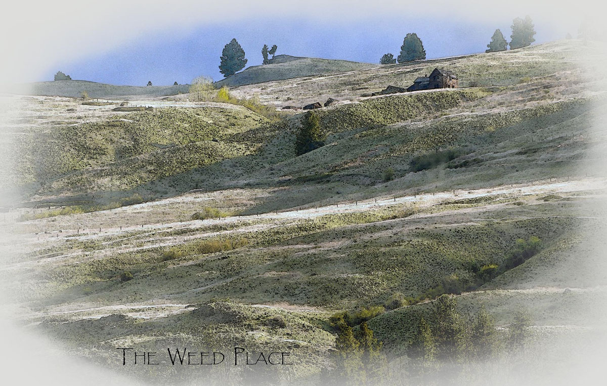 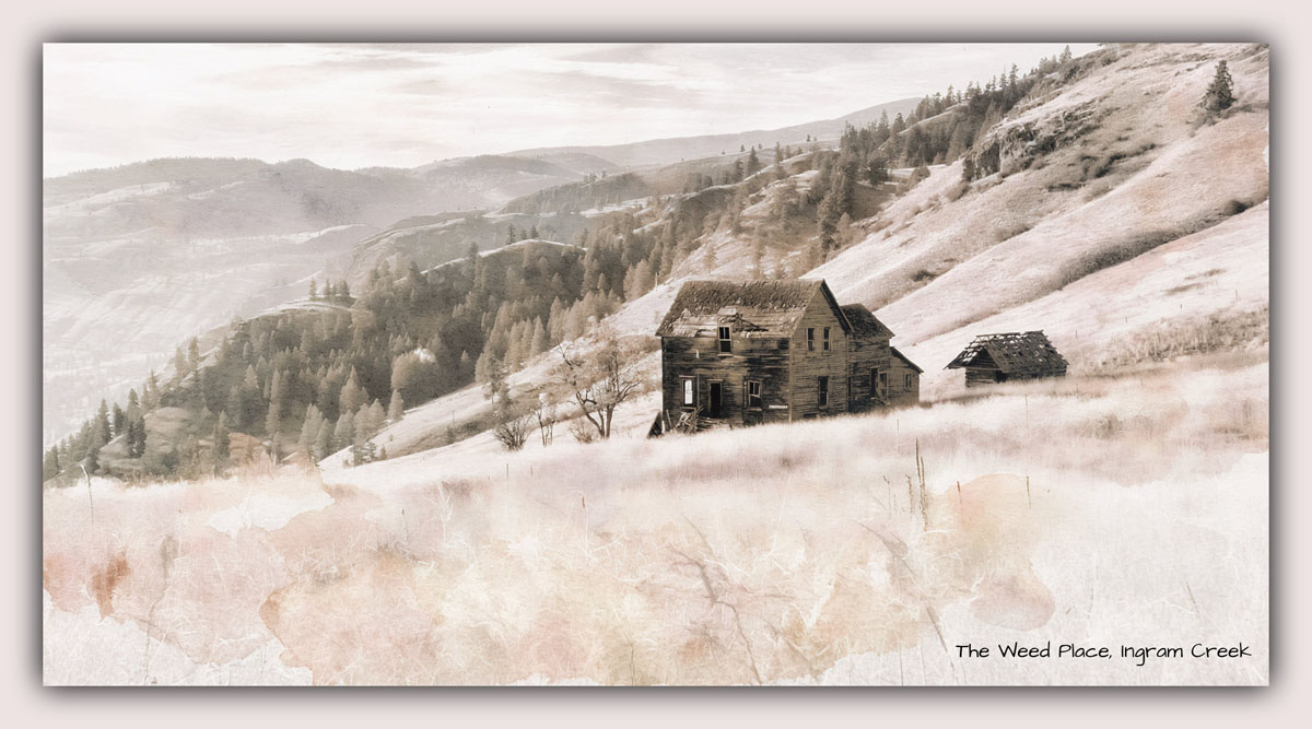 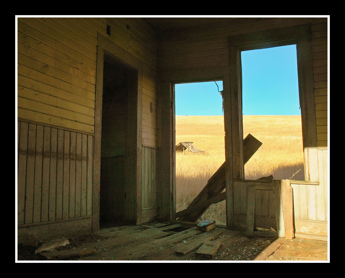 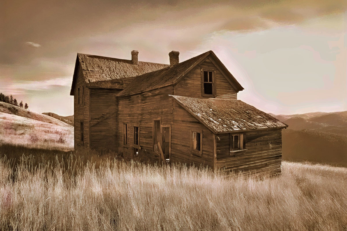 Update from Robin Dunham, 2011: Here are some updated pictures I took last year in February. 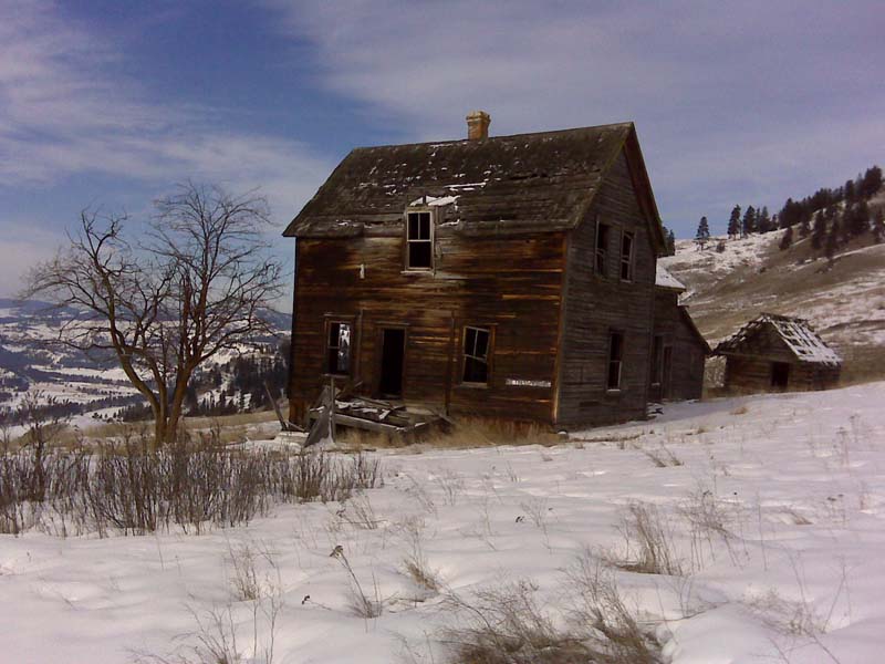 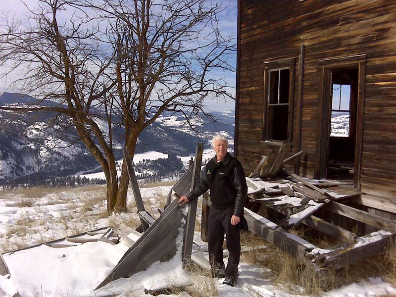 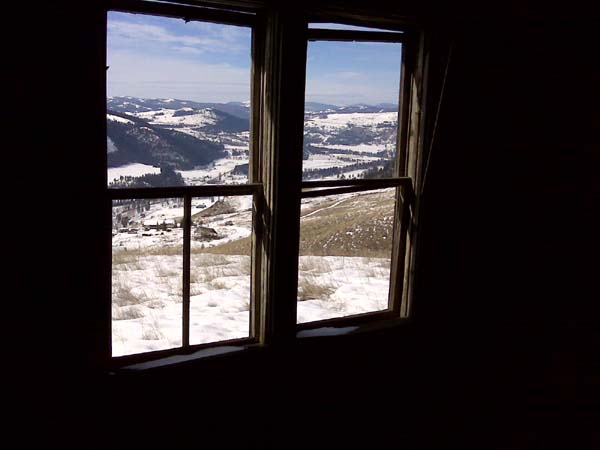 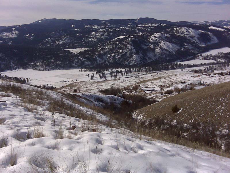  Note from Robin Dunham, 2009: My son Steven Dunham now owns Mark Taviston's place. There is lots of snow now so I am going to cross country ski to the Weed House and get some pictures with my cell phone. 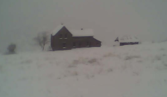 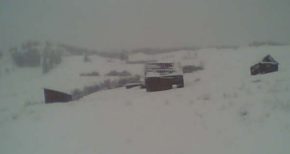 |