Return to main Vanishing B.C. page Return to home page
Page last updated November 26, 2003
© Michael Kluckner
|
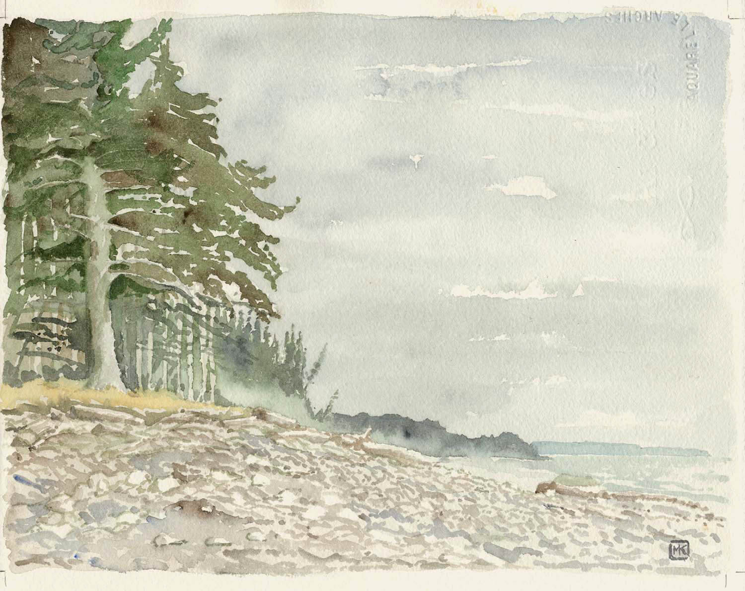
2003: Beach near Tlell, east coast of Graham Island (the north island of Haida Gwaii). I sat under an umbrella, which must have been one of the only umbrellas I saw during my time on Haida Gwaii – everyone seeming to prefer toques or the hoods on Gore-Tex jackets. Are umbrellas only for city wimps and watercolourists? Anyway, definable aspects of the scene, from my painter's viewpoint, are the Sitka spruce, the rocky beaches carved into bays that recede into the infinite distance, and the mist from the surf – the "misty islands" aspect of the place often celebrated in book, poetry, song and CBC interview. Yet this isn't technically an ocean beach, as it faces onto Hecate Strait, so the waves aren't surf in an official way. In fact, I was struck by the visual similarities between the seashore and the 19th century photographs of Haida villages: there is the same low storey of young trees=the houses and the tall storey of mature trees=totem poles, and the same transition, as in Haida culture, between the underworld of the sea and the transition to the earth and the skyworld. So although all the Haida villages are long gone, with only ghostly memories in the poles remaining at Skedans Village on Louise Island and, most famously, at Ninstints, "Red-cod-island town," the UNESCO World Heritage site on Anthony Island, there is a visual memory of it in landscapes like this one.
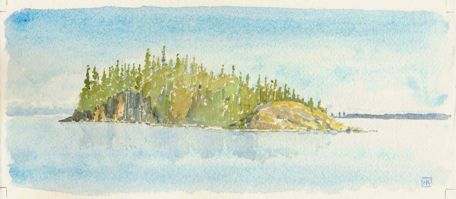
Torrens Island, like a ship floating in Rooney Bay just off Skidegate Village, unchanged for millenia. Clouds in the distance, a hundred kilometres away, over the mountains of the mainland, with the long low line of land leading to the aptly named Sandspit blue in the right distance.
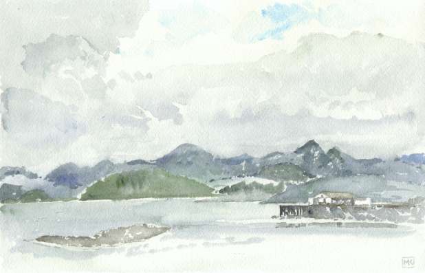
A rainstorm coming over Skidegate Inlet/Bearskin Bay, with the government dock at Queen Charlotte City and the fish storage house in the foreground. |