Return to main Vanishing B.C. page Return to home page
Page last updated September 26, 2006
© Michael Kluckner
|
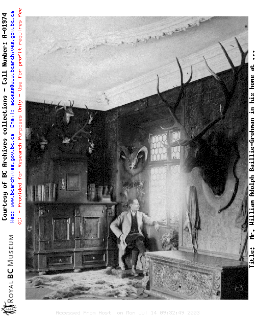
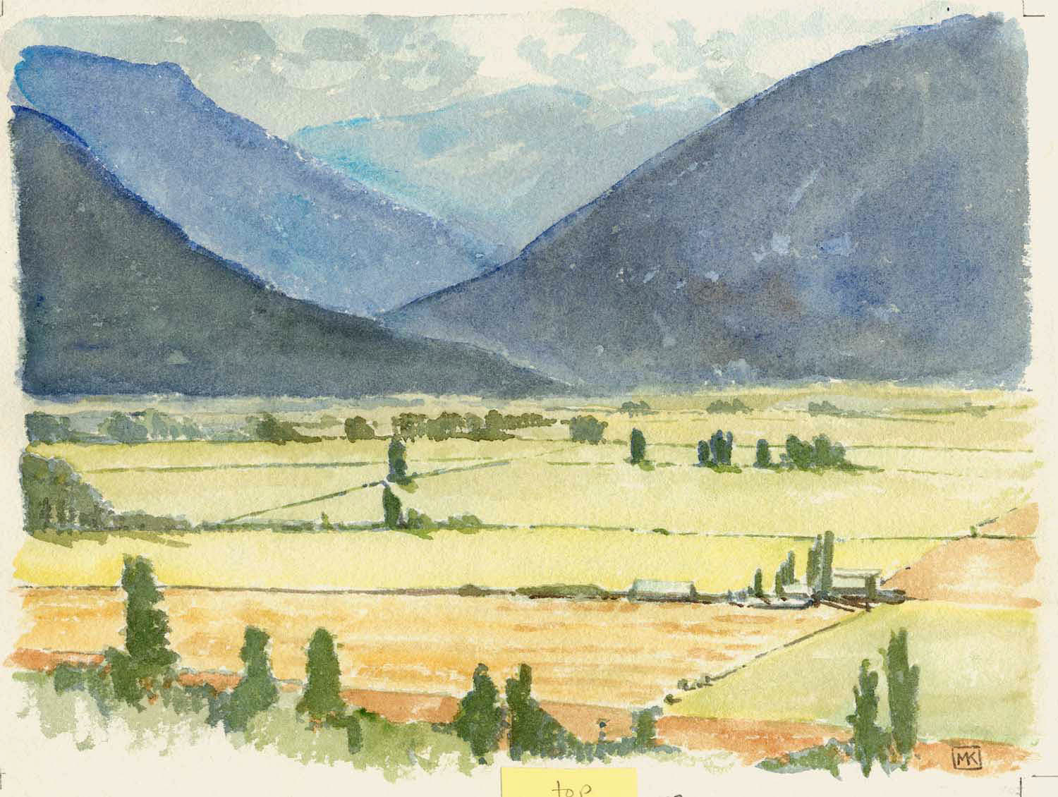
2002: After the steep, dramatic traverse of the Salmo-Creston highway, you emerge through the folds of mountains and cross a flat plain, divided like patchwork and dotted with barns and silos, heading toward Creston where, on the high ground, a line of grain elevators marks the railyards on the outskirts of town. It was from that point that I sat on the bank and looked back across the flats to sketch the scene above. This unexpected agricultural valley, producing enough grain to justify the set of elevators along the bluff at Creston (near where I sat to paint) and at Wynndel, is tied together historically with one of the most ambitious public works projects attempted in the 19th century: William Baillie-Grohman's attempt to reclaim the lowlands at the southern end of Kootenay Lake just north of Creston, divert water from the Kootenay River into the Columbia River at Canal Flats, and end the seasonal flooding of the Creston flats. It is reminiscent of another great dreamer a half-century later: Axel Wenner-Gren, whose plans for the economic development of the Peace River area entranced the W.A.C. Bennett government during the 1950s.
Some general historical information below that I've ripped off from the British Columbia Towns website; I'll replace it with some original research asap. "Nestled in the southern end of the Columbia River Valley is the community of Canal Flats, located just off Highway 93/95 that links Cranbrook in the south of the valley with Golden, about 140 miles (239 km) to the north. Canal Flats sits 1 kilometre from the southern end of the 16-kilometre long Columbia Lake, the source of the Columbia River that flows north to Kinbasket Lake before turning south to finally empty into the Pacific Ocean at Astoria, Oregon, a journey of 1,225 miles (1,960 kms). Columbia Lake lies squeezed between two walls of rock; the Purcell Mountains to the west and the Rocky Mountains to the east. In pre-Contact native America and the early years of western exploration, the Kootenay Valley was a major transportation corridor. Due to curiosity of geology, the headwaters of the vast Columbia River are separated from the south-flowing Kootenay River by a low, 1.2-mile wide (2-km) berm of land called Canal Flats. The Kootenay River then meanders down into the US before flowing back north into Canada to join the Columbia River at Castlegar, BC. "Canal Flats was originally named McGillivray's Portage by David Thompson, who passed through the area in 1808. Not far from the Canal Flats Provincial Park are the remains of a canal, completed in 1889, which connected Columbia Lake with the nearby Kootenay River, hence the name Canal Flats given to the post office in 1913. The canal was part of a scheme by English/Austrian entrepreneur William Adolph Baillie-Grohman in the 1880s to breach Canal Flats and divert water from the upper Kootenay River into the Columbia system, thereby sufficiently lowering the level of Kootenay Lake to reclaim the 48,000-acre rich alluvial plain in the Creston area and open up a north-south navigational system from Golden to Montana. The scheme was abandoned under pressure from the Canadian Pacific Railways, concerned about its Columbia River Crossings, and from settlers around Golden who feared that their farmlands would be flooded. Baillie-Grohman had to settle for building a canal and lock system between the two rivers, completed in 1889. Only two ships ever passed through the canal; in 1895 the vessel Gwendoline successfully navigated the canal from the Kootenay River to the Columbia River, followed in 1902 by the North Star. The canal builder owned the first store and post office in the community as well as the first steam sawmill in the valley, the start of the lumber industry that has put Canal Flats on the map. Canal Flats is the gateway to several backcountry provincial parks, including Whiteswan and Top of the World, and is an entrance to the Kootenay River Road. Location: Canal Flats is located just off Highway 93/95 at the southern end of Columbia Lake in the Kootenay River Valley, between Skookumchuk and Fairmont Hot Springs." The area is especially known today for its migratory bird population.
Note from
Ron Welwood, 2006: (this with reference to the Canal
Flats part of the book Vanishing British Columbia): "The
canal was part of a scheme by English/Austrian entrepreneur
William Adolph Baillie-Grohman in the 1880s to breach Canal
Flats and divert water from the upper Kootenay River into
the Columbia system, thereby sufficiently lowering the level
of Kootenay Lake to reclaim the 48,000-acre rich alluvial
plain in the Creston area and open up a north-south
navigational system from Golden to Montana." |