
Contact me Go to home page Return to main travel page
Peru
(& briefly Ecuador)
2017
*
Michael Kluckner
| A challenging if brief trip in January on
local buses and collectivos (small vans like jitneys) through the
most stunning mountain vistas I've ever seen, plus a couple of
days in the beach town Paracas and a few in the pretty oceanside
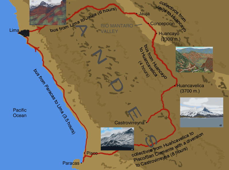
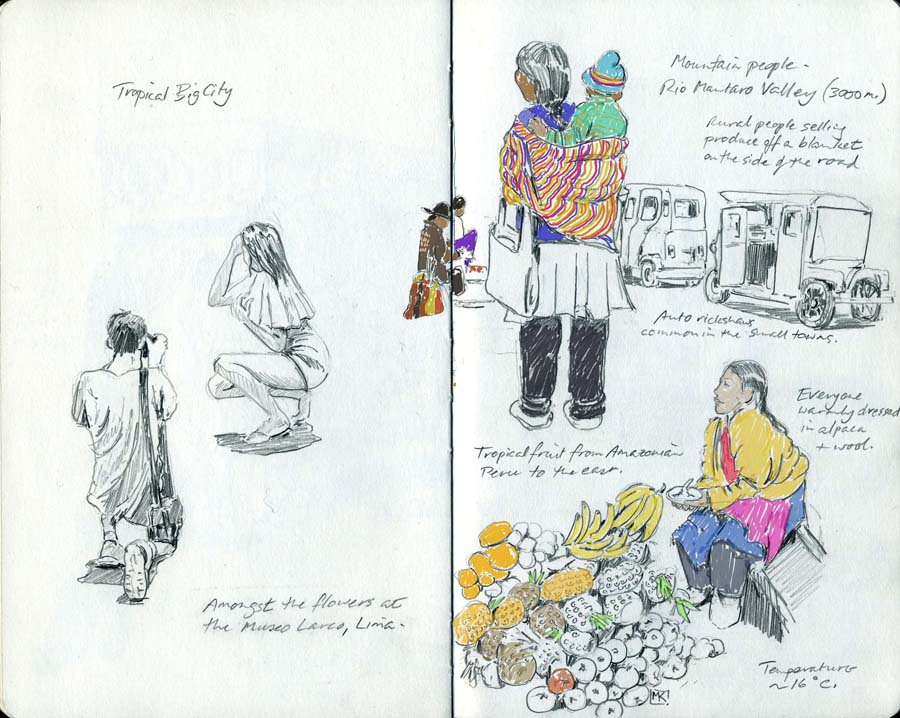
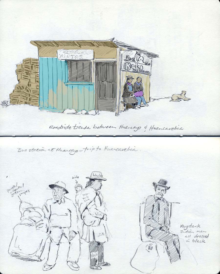
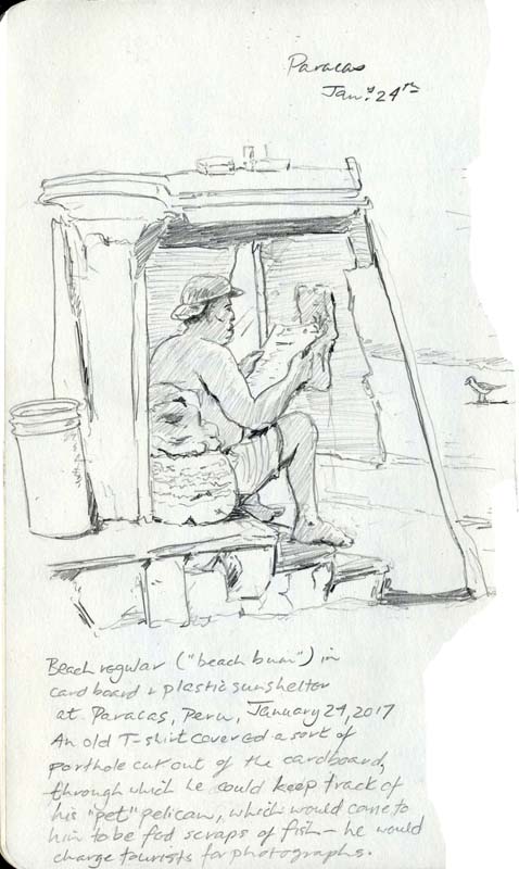
suburb of Miraflores in sprawling Lima. We did a lot of travelling and seemed to be on the move almost constantly, which made the couple of days in Paracas really laid back and pleasant. Coastal weather in Lima and Paracas was humid and about 30, i.e. hot and summery; in the mountains it was the rainy season, meaning daytime temperatures around 15 or so and some sun, cloud, and rain showers – real mountain weather, unpredictable from one hour to the next. And there were cold unheated hotel rooms – everyone wears alpaca sweaters for good reason. The Rio Mantaro Valley is an altiplano at about 3000 m. (10000 feet) above sea level, very fertile with plenty of trees. The extraordinary landscape is in the mountain passes between Jauja and Lima, and between Huancavelica and the coast, where you travel for hours without seeing a single tree through a folkloric landscape of grazing alpacas tended by mountain people in traditional costume. Seroche (altitude sickness) affected us a little, but chewing coca leaves and drinking maté coca tea – provided gratis in most of the places we stayed – seemed to keep it at bay, and we weren't forcing ourselves to hike and climb. We decided before we went not to follow the Gringo Trail to the tourist magnet Machu Picchu – we wanted instead to travel overland to see villages and people (& scenery) rather than fly, and the jumping-off point for Machu Picchu, the city of Cusco, is about 20 hours from Lima by bus. The question then became, how can we make a loop from Lima rather than doubling back from the Rio Mantaro valley towns? Huancavelica is especially historic and, according to the guidebook and a couple of blogs we read, well off the beaten path. Much of the challenge was figuring out how to get from Huancavelica to the coast, as there was little or no information on the web; the trip from Huancayo to Huancavelica was straightforward on good buses on okay (but very scary) roads. Here, then, in the hope that other travellers will find it, is our advice for getting from Huancayo to Huancavelica to Pisco and Paracas... read more (this opens as a pop-up on computers and a separate window on tablets). And here is a pop-up page of snapshots from my cellphone of unpaintable things. Christine's photos with a better camera than mine and her commentary are on her blog. About the artwork: we were taking photos out the windows of buses and collectivos; mine with my old Samsung cellphone are blurry, Christine's little Nikon did better, but neither of them captured the way the mountains towered above us. Even good cameras have a way of flattening space and compressing distance. The images below are digital, drawn in Photoshop on a Wacom tablet, recapturing the height and space and simplifying the colours, using the photos as references. The pencil drawings in the Moleskine sketchbook have some colour very roughly added digitally. |
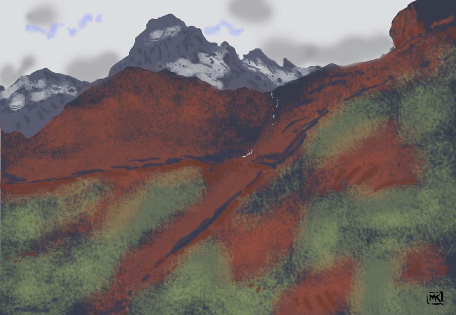
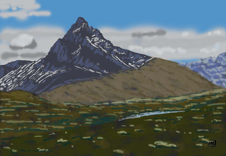
Lima to Jauja #1
Lima to Jauja #2
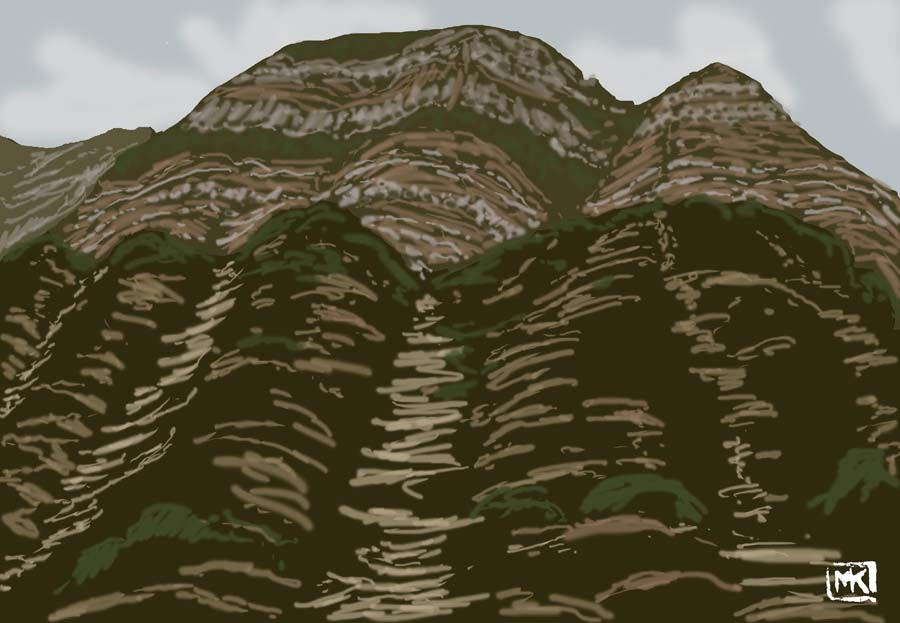
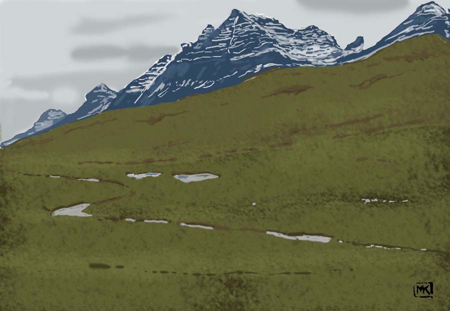
Terraced hillsides, switchback roads and steep canyons between Huancayo and Huancavelica
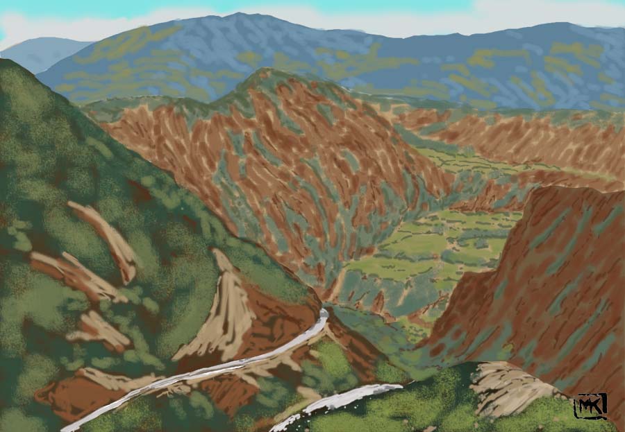
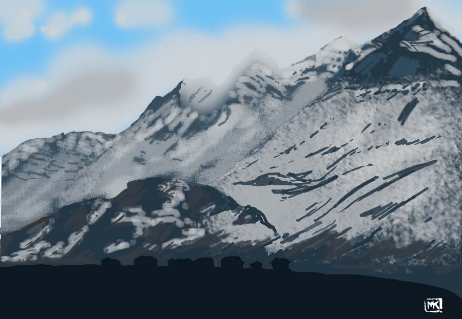
Huancavelica to Castrovirrenya #1
Huancavelica to Castrovirrenya #2
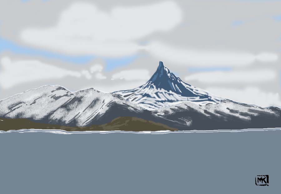
Looking across Lago Orcococha, one of the two big lakes (the other being Chocloco) in the high Andres south of Huancavelica.
I can't find the name of the mountain – it isn't tall enough to get on the list of highest peaks in Peru.
Between Huancavelica and Castrovirrenya there were a few almost-empty settlements, probably left over from abandoned mines, huddling below the mountain peaks.
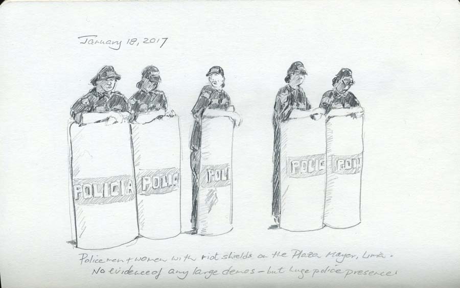
There was a huge police presence everywhere in Lima – in fact, everywhere in Peru – reflecting the "Shining Path" insurgency and other unrest.
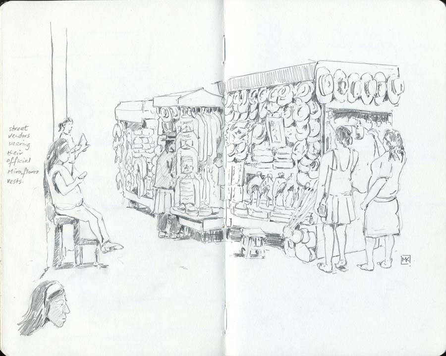
Vendors of hats, sweaters, and blankets on the street near our Miraflores hotel.
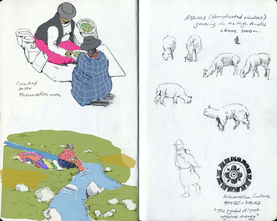
A common site from the collectivo window in the High Andes – women washing brightly coloured clothes in clear streams. Temperature about 10 degrees.
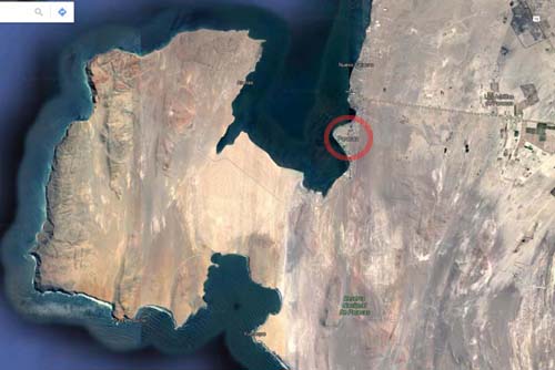
Paracas (circled) is a beach community on the edge of an incredible desert ecosystem. The Google satellite shows no trees for miles.
"Paracas" apparently means "sand rain."
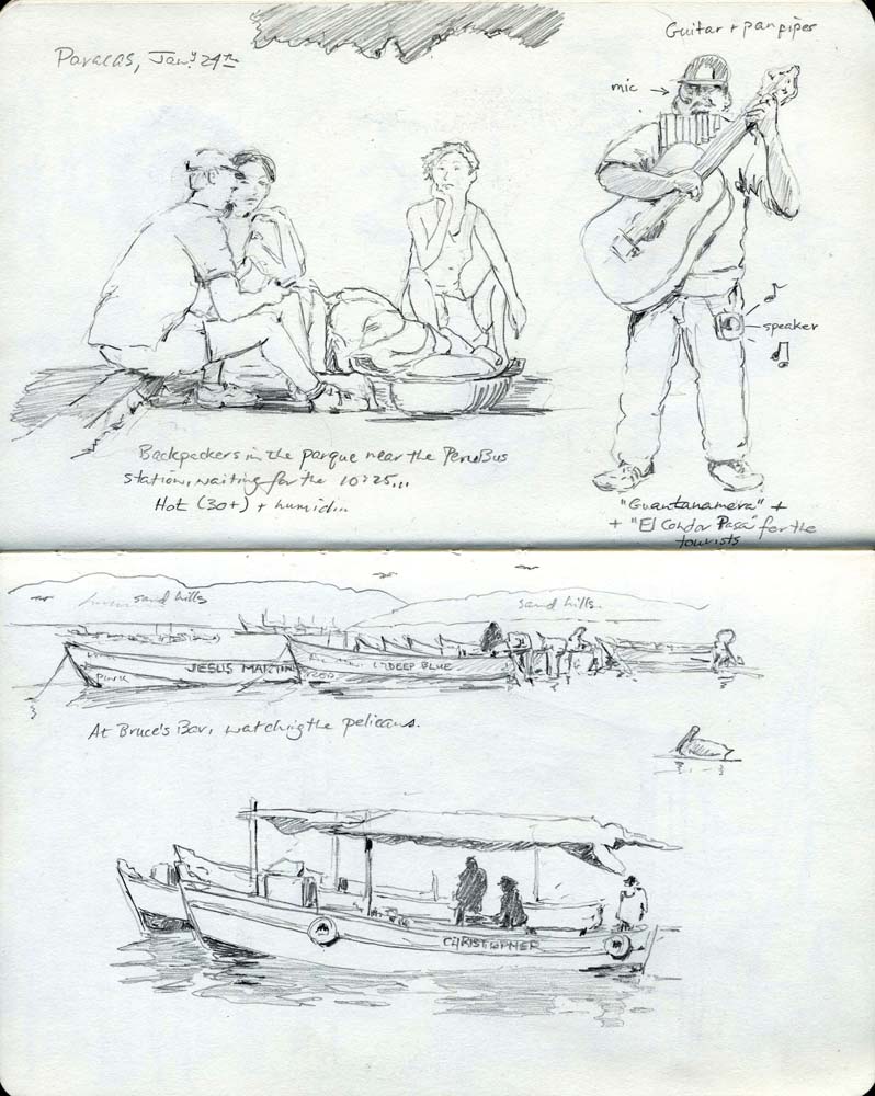
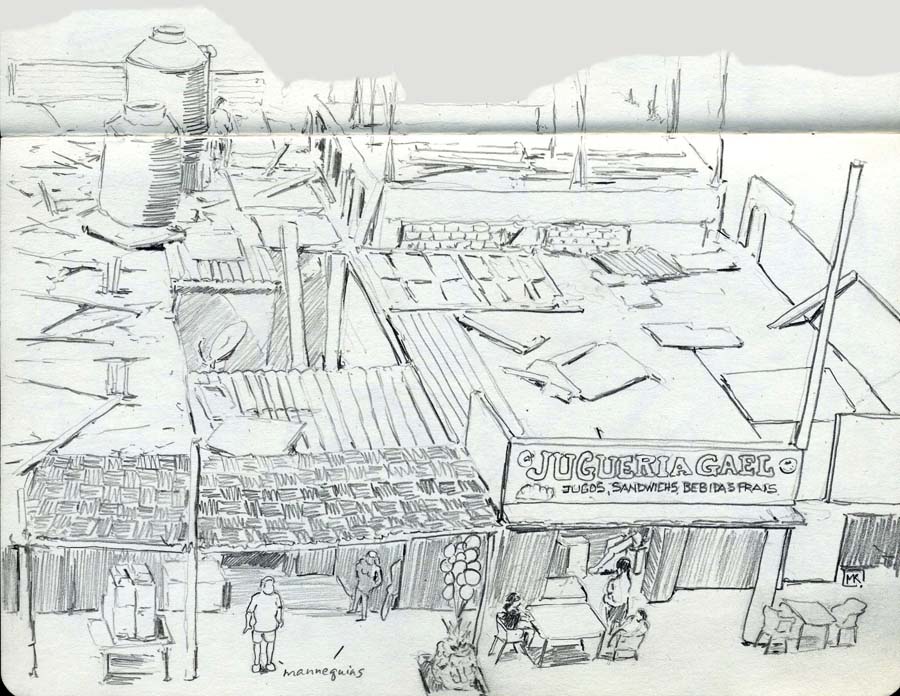
The view from our balcony at the charming, inexpensive Hotel Gamonal in Paracas; the shopfronts are tidy and animated, but the buildings' roofs are in incredible disarray.
Nearby Pisco was devastated a decade ago by an earthquake, and there were still signs of damage in Paracas as well.
We flew from Lima to Quito, Ecuador, and spent the last 5 days there and in the town of Otavalo two hours north...
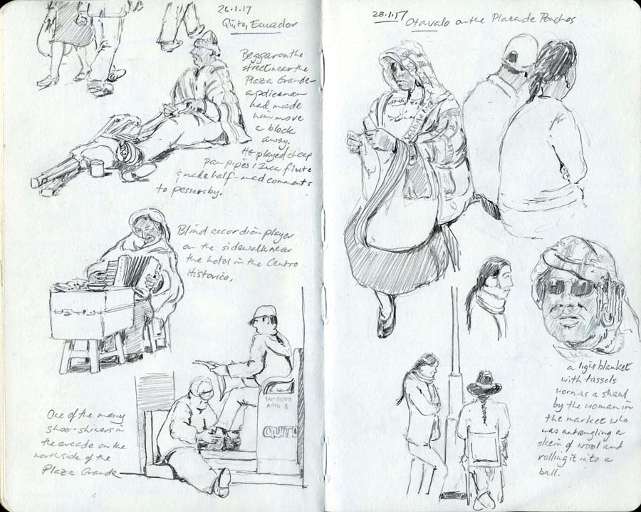
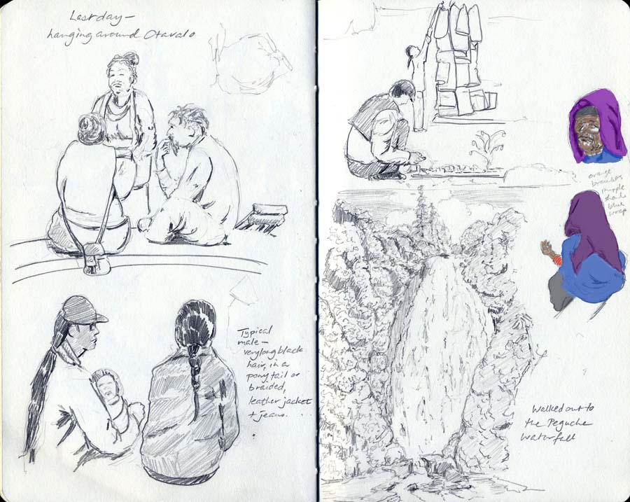
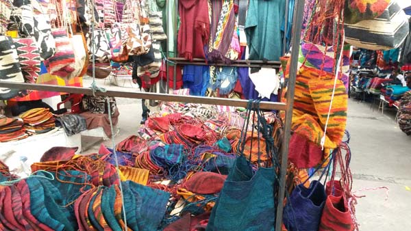
None of these, of course, capture the fabulous intense colours of the local clothing, bags and blankets...
More unpaintable things are in the snapshots file.
Contact me Go to home page Return to main travel page
Artwork & text © Michael Kluckner, 2017