Contact me Go to home page Return to main travel page
Arizona & New Mexico
2013
*
Michael Kluckner
 This
roadtrip was an example of the fingers-crossed, out-of-season
travel that we began 20 years ago with the three-month "winter
in the Mediterranean" sojourn; our previous trip, to Cuba
in October, 2012, was also not in prime time, as it was still
hurricane season, and we got clipped by 'Sandy,' proving our
travel luck is less than perfect. This
roadtrip was an example of the fingers-crossed, out-of-season
travel that we began 20 years ago with the three-month "winter
in the Mediterranean" sojourn; our previous trip, to Cuba
in October, 2012, was also not in prime time, as it was still
hurricane season, and we got clipped by 'Sandy,' proving our
travel luck is less than perfect. We travelled in the first half of January, definitely risk-taking behaviour away from the warm valley around Tucson and Phoenix, and were nipped by a deep cold snap that blanketed every State from coastal California to Texas; in the high-altitude places like the Grand Canyon (7000+ feet) and Santa Fe/Taos (7500 feet) it was really cold at night, the temperature dropping to -20 C. (-2 F.) with daytime temperatures around freezing. But the sun felt warm and there was the bonus of very few other people on the roads so we could wander as we pleased. The sky stayed blue for nearly the entire two weeks and, with the combination of low sun angle and crystal clear air, the vistas were extraordinary. We started from Phoenix with a rental car (a Prius due to the unavailability of the econo/compact we'd booked – thanks, Enterprise!) and covered about 3000 km/2000 miles. At that time of the year there's no need to book ahead and we were able to make up our plans as we went along, staying, for example, extra nights in Flagstaff and Albuquerque because we liked the towns and rooms, and getting incredible bargains, such as a room with a fireplace at the Old Santa Fe Inn for three nights that cost us one-third of the posted (high season) rate. |
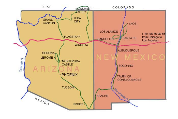
... our route indicated in green
| I've divided this trip into three parts: •"Vast Landscapes" begins immediately below •"Pueblo relics," the two Native American sites we visited •"Route 66 and ....", drawings of motels and bars ... and here are some snapshots with the cellphone camera of architecture and artwork by others that we saw along the way. |
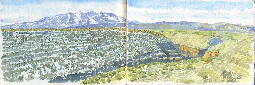
Vast Landscapes
| One box I always wanted to tick was painting the Grand Canyon,
to add to other chart-toppers like the Hagia Sophia in Instanbul,
Rome's Coliseum and the Acropolis that I've added to the
sketchbook over the years. Coming in a close second was the
landscapes of northeastern Arizona, familiar to anyone who has
seen, for example, John Ford westerns such as The Searchers
(unbearably racist to watch nowadays) and My Darling
Clementine; Sergio Leone used Monument Valley as a locating
shot in Once Upon a Time in the West – a couple on a
buckboard drive out into its immense emptiness and, in the next
scene, arrive at a comfortable little homestead in a snug valley
as if in time for lunch! The colourful rocky landscape of the
desert is a feature of more recent programs too, such as Breaking
Bad, set in Albuquerque. The challenge is: how do you paint 'vast' in a sketchbook, i.e. on a small piece of paper? A good selection of blue pigments certainly helps. Watercolour has such a small tonal range compared with oils (or camera pixels) that you need the winter light and low sun angle to help define forms in space. In summer with its black shadows and high sun angles, watercolours would look as flat as Georgia O'Keeffe's landscapes, without the benefit of her oil painter's brushy surface. I was surprised at how few really large landscape paintings we saw in galleries and museums, and how few abstracted interpretations there were; the style was usually realism, sometimes with a modernist touch, on salon-sized canvases. The biggest paintings in museums and galleries were expressionist and abstract, just like museum art everywhere else in the world. [The single-panel watercolours are on 7 1/2 x 11 inch pieces of Arches paper (1/8th of an Imperial sheet). The double-panel ones go 'across the fold' – i.e. they're on a 7 1/2 x 22 inch sheet.] |
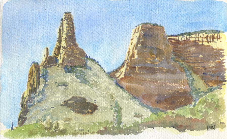
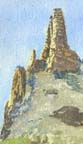
Fabulous rock chimneys near Oak Creek, the little community south of Sedona, Arizona. Well above freezing and pleasant to sit outside and paint.
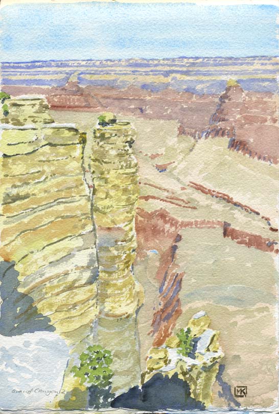 |
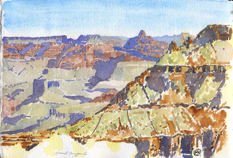
(Above) Just a little slice of the Grand
Canyon, looking out from the pathway along the south rim. Of the
three primary colours in reflected light, the yellow drops
first, then the red, leaving just the blue in the extreme
distance; thus, the foreground has a lot of burnt sienna in it
and a strong blue colour called Payne's Grey; the middle ground
has ultramarine shadows and flat red forms, then the shadows
shift to cobalt (a cooler blue), finally cerulean for the
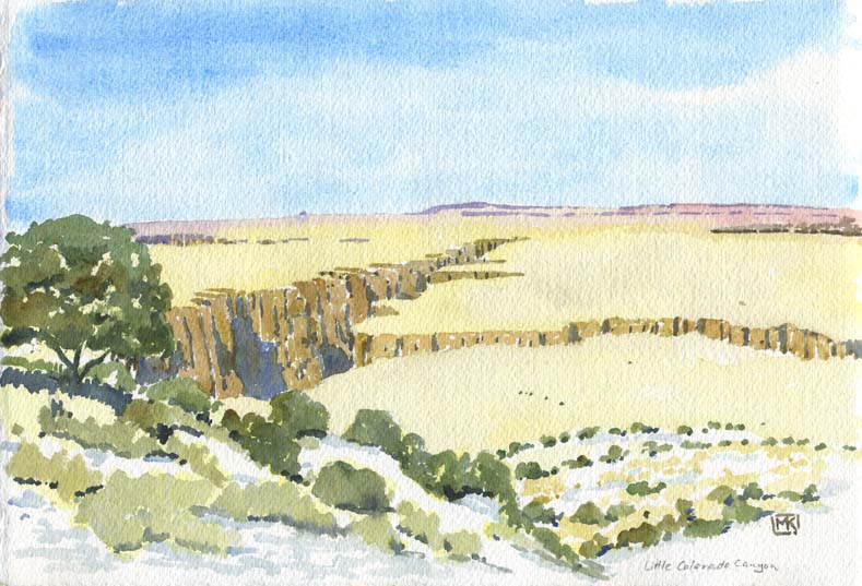
distant mountains. (Left) Stacks of rock form the south rim above the canyon floor, a mile below, with a tiny crescent of blue indicating the meandering course of the Colorado River. How could a little river like it have eroded a canyon 9 miles wide? Patience, I suppose. It had all the time in the world. It must have been a grander river in past ages; it seemed practically dried out due to irrigation demands further north and the constant drought. (Below) East of the Grand Canyon the land opens out into a vast plain, dry as dust and cut deeply by the Little Colorado River, as if a celestial craftsman with a large router had cut out a narrow channel. The erosion didn't spread as it had in the Grand Canyon, and there are no horizontal stripes of rock here, but the distant hills glow a purple-red. |
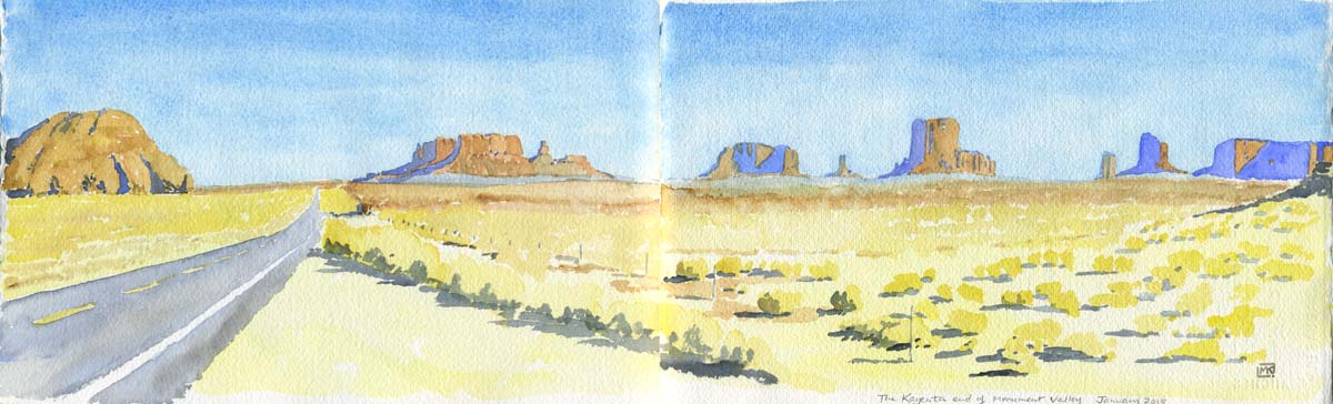
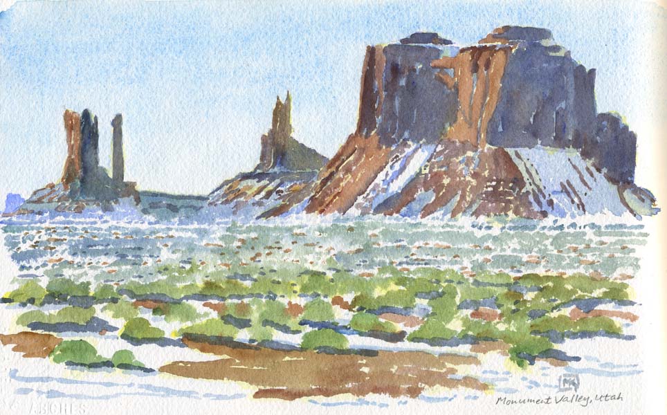
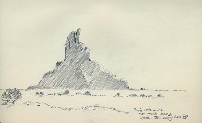 You enter Monument Valley just north of Kayenta, Arizona;
it's all Navajo land running northwards into Utah and across
into New Mexico and Colorado. As is often said about the
prairies/Great Plains, you could watch a dog running away for
two days; it's one of the few places I've ever been where a
highway diminishes like an arrow to a point (classic one-point
perspective) but, with the air so clear, you can see even
further to the horizon. I indicated a little Navajo shelter
along the roadside in the near distance, a ramshackle place used
in the tourist season for selling jewellery and crafts – they
were common from the edge of Grand Canyon National Park all the
way through the area. The winter shadows are an endless
succession of blues, from Paynes Grey in the foreground through
Ultramarine to Cobalt to Cerulean. There was one rock form,
towering above a tiny homestead, that unmistakeably gave us the
finger soon after we crossed into Utah. I didn't distort it at
all in the drawing!
You enter Monument Valley just north of Kayenta, Arizona;
it's all Navajo land running northwards into Utah and across
into New Mexico and Colorado. As is often said about the
prairies/Great Plains, you could watch a dog running away for
two days; it's one of the few places I've ever been where a
highway diminishes like an arrow to a point (classic one-point
perspective) but, with the air so clear, you can see even
further to the horizon. I indicated a little Navajo shelter
along the roadside in the near distance, a ramshackle place used
in the tourist season for selling jewellery and crafts – they
were common from the edge of Grand Canyon National Park all the
way through the area. The winter shadows are an endless
succession of blues, from Paynes Grey in the foreground through
Ultramarine to Cobalt to Cerulean. There was one rock form,
towering above a tiny homestead, that unmistakeably gave us the
finger soon after we crossed into Utah. I didn't distort it at
all in the drawing!(Below) Snow, remaining in every piece of shadowed ground and on every sheltered rockface, further along in "the valley." Monument Valley is misnamed, at least in its second word; you can see for a hundred miles to distant hills. |
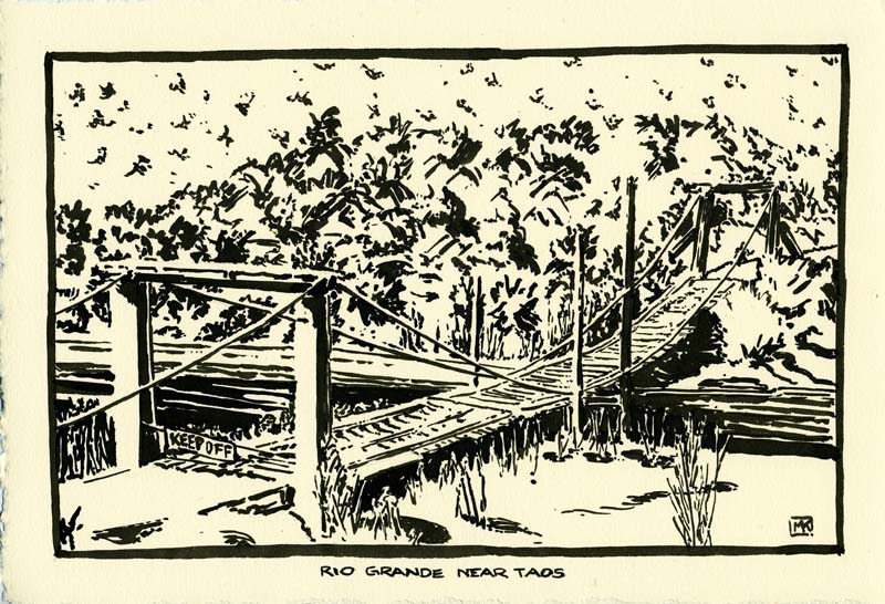
A rickety bridge crosses the Rio Grande, more the Rio Pequeño at this point, in the mountains south of Taos.
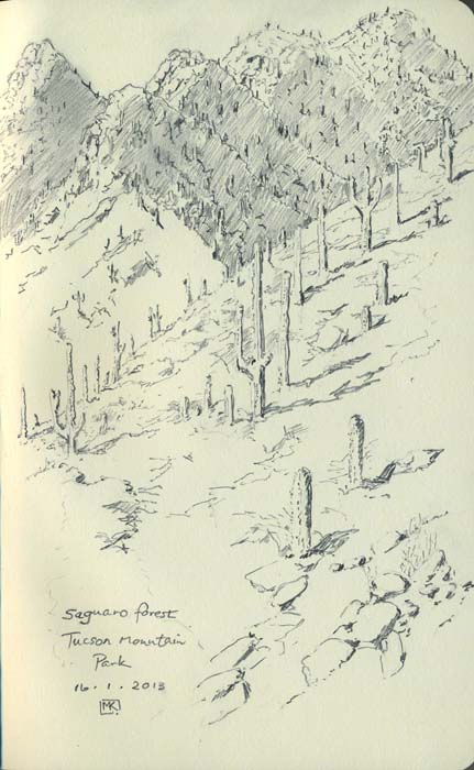 |
The mountains near Tucson, southeast of Phoenix, are home
to all the fabulous cactus of the Sonoran desert, especially the
Saguaro, which arch and branch like spiny scarecrows. |
Pueblo Relics
| We visited just two of the many ancient pueblo sites in Arizona
and New Mexico, "Montezuma Castle" in the Verde Valley and
Bandelier, both national parks, both well-interpreted for people
who want to ramble around without a guide (or sit and paint). Both
were magical places, skilfully sited and engineered to make the
best of a harsh climate. Bandelier had an extra dimension, as it was tucked away in the mountains near another community that needed isolation to accomplish its goals: Los Alamos, where the atomic bomb was developed in great secrecy in the 1940s. After visiting Bandelier and absorbing its ghosts, we went to the Los Alamos "science museum" which presents a gung-ho history of the development of the bomb (and its role in "freedom," the catch-all term for doing things the American way), along with other, more restrained displays on aspects of research into nuclear medicine; thoroughly creeped-out by the experience, we certainly didn't try to get close to Alomogordo, in southeastern New Mexico, where the first bomb was detonated in 1945 at the Trinity Site. My life (so far) neatly spans most of the atomic era, and I can't help being fascinated by the larger-than-life characters who adapted science to such devastating effect; I spent that evening in the hotel room reading everything I could on Los Alamos, Oppenheimer, Teller and the rest on Wikipedia. |
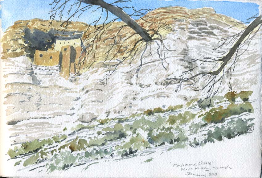
| The Sinagua farmers (so named because the area was "sin
agua," without water, in Spanish), built extraordinary dwellings
in the Verde Valley about 1100 CE, that is, 900 years ago, and
abandoned them sometime in the 1400s for unknown reasons –
perhaps climate change, soil depletion or conflict. The pueblo
set into the south-facing, carved-out wall on this rockface is
so grand that early colonists believed it to be an Aztec place
and misnamed it Montezuma Castle. It sits above meadows along a
river ... |
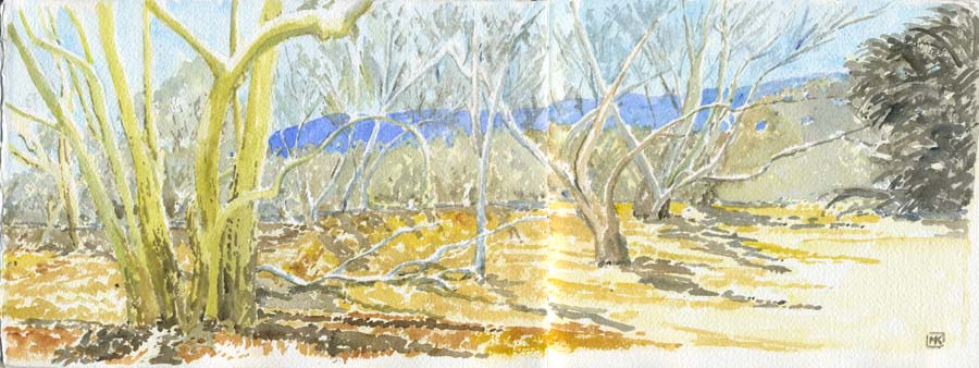
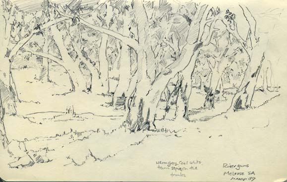
| ... lined with Arizona sycamores, whose
ghostly pale trunks reflect the golden leaves they had shed at
the beginning of winter. (Right) I thought, "I've been here before," but it was in a different country – South Australia, where smooth, pale-barked river gums line every watercourse. I drew them in 2009 on the camper-van odyssey. The combination of the cliff dwellings, the fields, the river and the memory of agriculture several hundred years ago was enchanting, an arcadia that mysteriously ended a century or more before the Spanish arrived. There is another magical site nearby, Montezuma Well, a lake fed by springs in the middle of the desert formed when a limestone cavern collapsed. It had the same atmosphere of paradise clinging to it, of tranquil agriculture by pastoral ancient peoples, and it was easy to imagine swimming in it on a hot day. However, it apparently teems with leeches that thrive in the mineral-rich water... |
 |
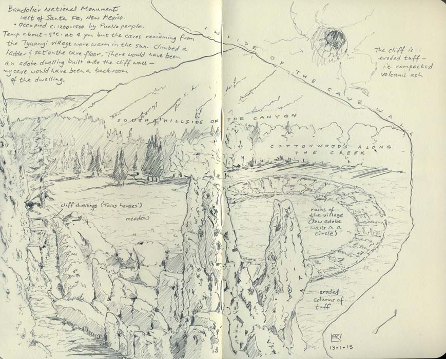
| Bandelier, late on a winter afternoon, the shadow just
beginning to climb the rock face where Ancestral Pueblo people
built their dwellings and lived from c. 1100 to the 1500s. They
were farmers who grew maize, beans and squash, kept turkeys,
cultivated cotton, and traded with other people as far away as
central Mexico (evidenced by the remains of parrots). There was
still snow on the north-facing slope of the canyon but the
interior of the cave where I sat to draw (below) was
warm in the sunshine. The village consisted of the cliff
dwellings, worked into the eroded caves of soft tuff created by
compressed ancient volcanic ash, and a circular settlement on
the valley floor that contained numerous small rooms, many used
for storage, as well as three pit houses, accessed by ladders,
where spiritual ceremonies took place. Only low adobe walls
remain on the valley floor and along the cliff face, although
two "Talus houses" have been recreated against the cliff. |
Route 66 and ...
 Steinbeck's
"mother road," the historic Route 66 of novels, songs and TV fame,
has been mostly wiped out by Interstate 40; the remaining bits,
such as the strips through Flagstaff, Gallup and Albuquerque, have
been homogenized by the passage of time and the spread of chain
motels and fast-food outlets. We crossed Route 66 at Flagstaff and
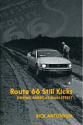
drove the section (actually I-40) from Gallup to Albuquerque. By
coincidence, a couple of acquaintances from our neck of the woods,
both deeply involved in tourism and the travel industry, had
recently driven the entire length of it from Chicago to LA,
getting off I-40 for every vestige of the historic road, and
published the journey as Route 66 Still Kicks: Driving
America's Main Street (by Rick Antonson, Dundurn Press,
2012): a great "buddy book," entertaining to read with lots of
lore gleaned along the way. They stayed in the Hotel Monte Vista
in Flagstaff, as did we, but bypassed ABQ in favour of a classic
motel in Gallup. Steinbeck's
"mother road," the historic Route 66 of novels, songs and TV fame,
has been mostly wiped out by Interstate 40; the remaining bits,
such as the strips through Flagstaff, Gallup and Albuquerque, have
been homogenized by the passage of time and the spread of chain
motels and fast-food outlets. We crossed Route 66 at Flagstaff and
drove the section (actually I-40) from Gallup to Albuquerque. By
coincidence, a couple of acquaintances from our neck of the woods,
both deeply involved in tourism and the travel industry, had
recently driven the entire length of it from Chicago to LA,
getting off I-40 for every vestige of the historic road, and
published the journey as Route 66 Still Kicks: Driving
America's Main Street (by Rick Antonson, Dundurn Press,
2012): a great "buddy book," entertaining to read with lots of
lore gleaned along the way. They stayed in the Hotel Monte Vista
in Flagstaff, as did we, but bypassed ABQ in favour of a classic
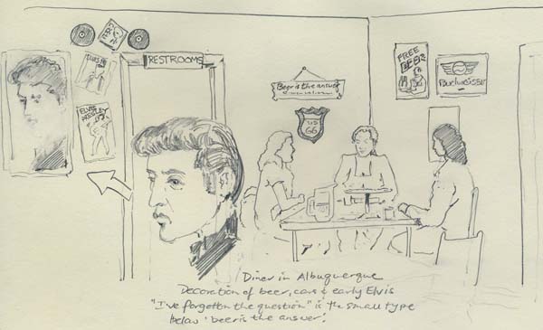
motel in Gallup.Nostalgia clings to the surviving diners (in both senses: the cafés and the patrons), usually conflating the Route 66 medallion, beer ads with slogans like "Beer is the answer (I've forgotten the question)," vintage musclecars like Corvettes from the Route 66 TV show of the 1960s, and early rock 'n' roll. Some snapshots of signs and places along the roadside. (Below) I scribbled the decor of an Albuquerque diner into the small sketchbook while we waited for a pizza one night. |
 |
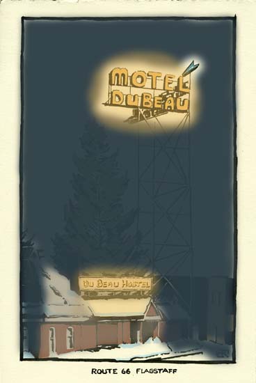 |
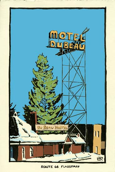
| The Dubeau, like the Monte Vista (with a snapshot in the
linked set above), is a couple of blocks off Route 66 and has a
"double 45 degree" sign to attract motorists' attention. It is
no longer running as a motel, rather as a hostel for the nearby
university, and its tall sign is no longer working. It probably
looked something like the right-hand image in its heyday. |
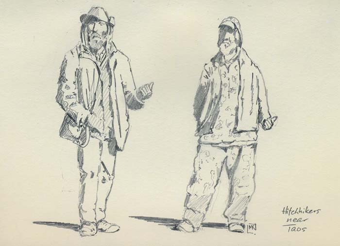
| There are not many hitchhikers anymore and the ones left
are a different breed from earlier years. I couldn't get the
tune of the Jackson Browne/Eagles song "Take it Easy" out of my
head for much of the trip because of its opening verse about
"standin' on the corner in Winslow Arizona / such a fine sight
to see / it's a girl my Lord in a flat-bed Ford / slowin' down
to take a look at me." That was a time of innocent travellers,
perhaps, compared with these dudes who looked like extras from
the Cormac McCarthy film The Road. A hitchhiker wearing
bulky camo (i.e. camouflage clothing) begs the question, is the
camo concealing any ammo? No idea how long it took them to get a
ride. And we never went to Winslow, missing it due to the long
loop we took northward through Monument Valley, but I would like
to have seen the monument the town of Winslow erected to the
song. A bit of tourist bumf in Flagstaff claimed that the
original lyrics mentioned Flagstaff, not Winslow, but the Eagles
selected the latter as easier to sing. |
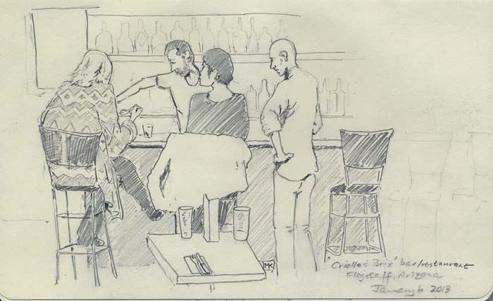
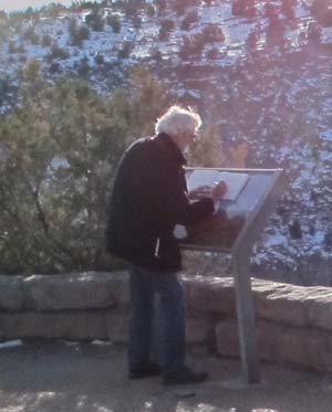
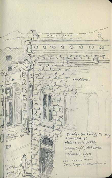
| I could have spent many more days drawing in Flagstaff;
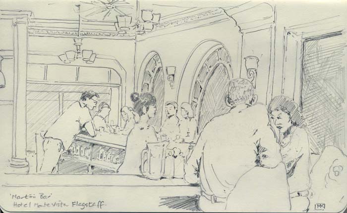
only the cold kept my drawing hand indoors or in glove. The Hotel Monte Vista (see the photo in the pop-up link at the top of this section) was a great oasis, with all the character of a 1920s building, supplemented with pop culture-themed decor in the rooms. We inspected the Humphrey Bogart Room but it was painted black – and thus should have been the Mick Jagger Room – settling instead on the Freddy Mercury Room, decorated in tasteful purple, with a fine view out its window onto the street (right). Just to demonstrate the owners' sense of humour/irony, the rooms across the hall were themed macho and named for John Wayne and Lee Marvin! The hotel's Martini Bar (below) made a terrific, head-banger classic gin martini, big enough that you could bathe a small bird in the glass. The view inside, and outside onto the snowy street, would have inspired Edward Hopper. |
 |
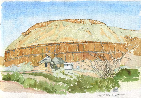
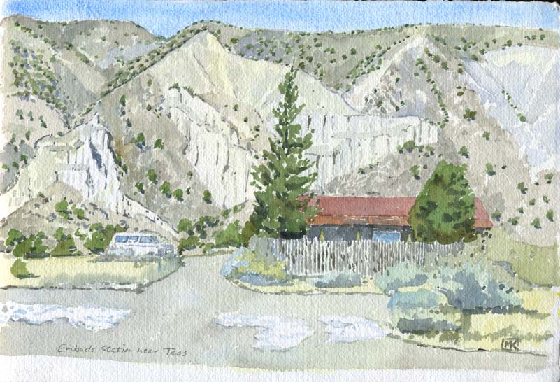
| Above: collapsed adobe houses and travel trailer on the
edge of Tuba City, Arizona (there were no visible tubas in Tuba
City) Below: Embudo Station, in the rough hills south of Taos, New Mexico |
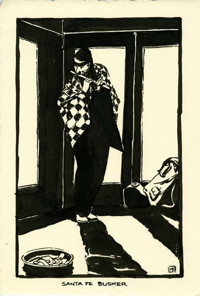
| He was playin' real good for free, as Joni Mitchell once
sang. We came out of a Santa Fe restaurant at about 9 on a
bitterly cold night and heard a flute playing, as it turned out
in the doorway of a shop right where we'd parked, protected a
little from the chill, the adobe walls and glass creating an
eerie echo of his tune. Gave him a dollar and wondered where he
was going to spend the night. |
 |
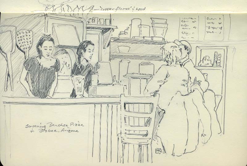
| Bisbee is the "Copper Queen" and Screaming Banshee Pizza,
located in an old gas station near the northern end of town, had
copper flames and a copper hood on its wood-burning pizza oven.
And the town had great architecture and galleries ... reasons to
visit again. |
Contact me Go to home page Return to main travel page
Artwork & text © Michael Kluckner, 2013