Return to main travel page Return to home page
I travelled to Savary Island, in the Strait of Georgia near Powell River, in June, 2004. I had been asked to paint a few commissions for people there, and also to paint a few watercolours for the Savary Island Land Trust fundraising auction. I also spent the remaining time that week adding images to my sketchbook. Thanks to Liz Webster for the use of her charming, rustic cottage.
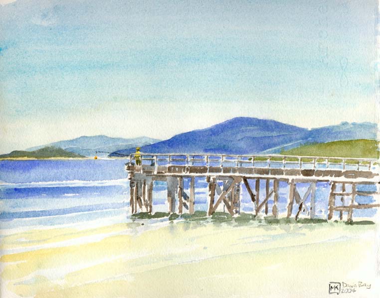
Everything was going according to plan until, just before I was to board the Earl's Cove-Saltery Bay ferry, I noticed something dripping underneath my old pickup truck. To my horror, it was gasoline – the gas tank had sprung a leak due to corrosion and old age. So I pulled out of the ferry lineup and backtracked along the Sunshine Coast, looking for a garage that could fix it and, at least, drain the tank. I eventually found a Canadian Tire outlet on the hill above Davis Bay which could do the job asap, and hiked down to the beach where I set up residence in a motel. I guess it was about 36 hours before they were able to get a tank shipped up on the Greyhound and install it. So that's why there are a couple of images below from there (and still a few more, abandoned since, in the sketchbook).
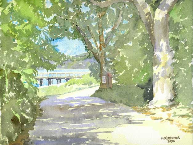
A favorite spot on Savary, where the narrow roadway that runs along the island's spine descends the hill and emerges at the beach near the Government Dock. Dappled tree trunks and bushes, the shadows infused with purple-blue light. [Went back in 2013 and found the bush on the right all cleared out, all changed; couldn't really figure out what I had painted.]
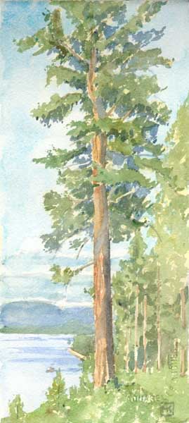
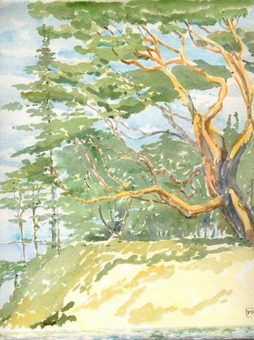
One of the magnificent trees on the sheltered (north) side of the island, along the main roadway that connects the Government Dock with Indian Point and the site of the old Royal Savary Hotel.
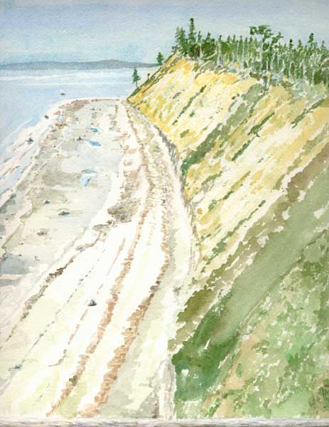
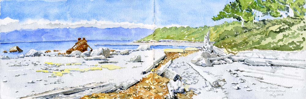
The fabulous sand cliffs on the south side of the island, so striking that Capt. Vancouver noted them in his journal in 1792. To attempt to stabilize the cliffs, islanders years ago planted broom, a non-native invasive plant that has also colonized the rest of the island. While I was painting, a couple walked the length of the beach: I indicated them with a few tiny brushstrokes with my smallest brush, as indicated below
The huge arbutus tree, according to islanders the largest on the coast (disputed by residents of other islands), on the south side of the island.
2013: went back to Savary for a few days for the SILT art auction and stayed in the same cabin (thanks, Liz). Had an opportunity to wander all over the place on foot and by bicycle, and put the two images below, of the south and north beaches, into the sketchbook... I left them just as they were when we left the island, a bit unfinished and showing the "hard paper" quality of watercolours done outdoors on a hot dry day.

***
Davis Bay (a charming beach-side community just south of the town of Sechelt), 2004
[Note from Brian Freemantle, Prince George: When I lived in Sechelt from 1975-78 (my younger son was born there), the old-timers still referred to Davis Bay by its actual name of Davies Bay. At least that’s the name on the old maps of the area. The name only changed because people were too lazy to the pronounce the name the way it was spelled. At least that’s my take on it.]
I think the original Davies must have been Welsh. Seems to me that the Welsh pronounce Davies as "Davis."
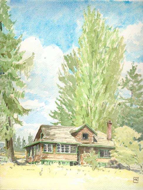
While I was killing time, waiting to get an answer on how long it would take to fix the gas tank on my truck, I spotted an abandoned house at the corner of Field Road and the Sunshine Coast highway. It was derelict and awaiting demolition, it seemed.
Does anyone know anything about this place? Is it still there? What's going onto the site? (A guess: some strip mall or another.)