
Contact me Go to home page Return to main travel page
The Yukon
2012
*
Michael Kluckner
  |
My third trip to the Yukon and the
first at the beginning of autumn – the others were in the Junes
of '96 and 2000, when I attended Heritage Canada board meetings,
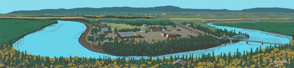
the second of which was in Dawson City (below).
I made another trip to Whitehorse but only as a starting point
to get to Atlin
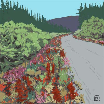
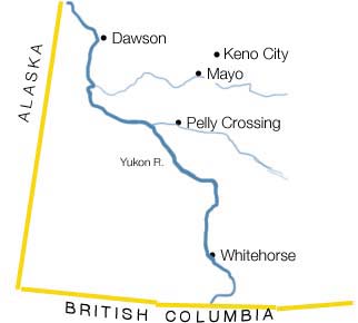
in northwestern BC. On this trip, at the end of August, Brent and Meg had me paint some watercolours around Whitehorse for themselves, and I drove with Brent out into "The Communities," as Yukoners describe the outpost settlements away from their metropolis (population 26,000) – the remaining 10,000 inhabitants of the Yukon are thinly scattered across that immensely vast chunk of northern Canada. The destination of our road trip was Elsa/Keno City, at about the same latitude as Dawson City but a few hundred kilometres further inland. In the 1960s/70s, if you wanted to purchase a home, start a business or return to school, you could get a high-paying job in the silver mines in the area, live in camp and save a bundle. United Keno Hill Mines was the name I remember, a successor (as an employer) to the Distant Early Warning [DEW Line] installations even further north intended to warn North Americans of Soviet attack in the 1950s. Another legendary destination for job-seekers was the WAC Bennett Dam in the Peace region of BC, also during the 1960s. I remember the men who worked there around 1970, addicted to the comforts of camp life and good money, and it was certainly the same at Elsa, Keno Hill and Faro. Those mines were closed for years but are reopening due to strong metal markets. But it's a different world now: miners "fly in - fly out" and there is little community-building compared with generations ago. Fort McMurray, Alberta, and the tar ... oops, oil sands are the current equivalent destination. This from Wikipedia: "Keno City is a small community in the Yukon at the end of the Silver Trail highway. Population was about 20 in 2001. Keno City was the site of a former silver-lead mining area proximal to Keno Hill. Keno City is 13 kilometres away from the Elsa Mine, which is owned by Alexco Resource Corp who currently own and operate the various Ag-Pb-Zn deposits in the Keno Hill area. Rich silver and lead ore deposits were found on Keno Hill in 1919, and since then the population of the community has fluctuated in response to the mining activity in the area." It was about a six-hour drive from Whitehorse to Keno City; the only overnighting spot and café was in Mayo. The road passes through extraordinary landscapes of moose pasture, long long vistas across boreal forest, places where the spruce trees (max. about 25 feet tall) are twisted and angled by winds that harry them on the thin layer of soil above the permafrost, and splendid views of the Yukon and Stewart rivers. (Left above) The roadsides in late summer are ribbons of bright colour as the fireweed and clover flame in the low sunlight. The air is sharp and clear like diamonds. (This is a digital painting, using my new toy, a Bamboo Create tablet. There's another one below of Pelly Crossing. The 2 watercolours below are about 12 x 16"; the other watercolours of Dawson City at the bottom of the page are from a sketchbook, i.e about 8 x 10 inches. The brush & Chinese ink pictures are on 8 x 11 pieces of Rising Stonehenge "natural" paper, continuing my enthusiasm for woodcut-like chiaroscuro images. The pencil drawings are from a Moleskine sketchbook, which also has buff-tinted paper.) |

Above: the Yukon River at Whitehorse with the old "Klondike" paddlewheeler beached on the shoreline.
Below: Miles Canyon on the Yukon River, just south of Whitehorse, one of the treacherous traverses for the miners en route to the Klondike in 1898.
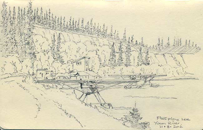
| Above: Just downstream of Miles Canyon the river widens
out; there are few modern things that say "The North" better
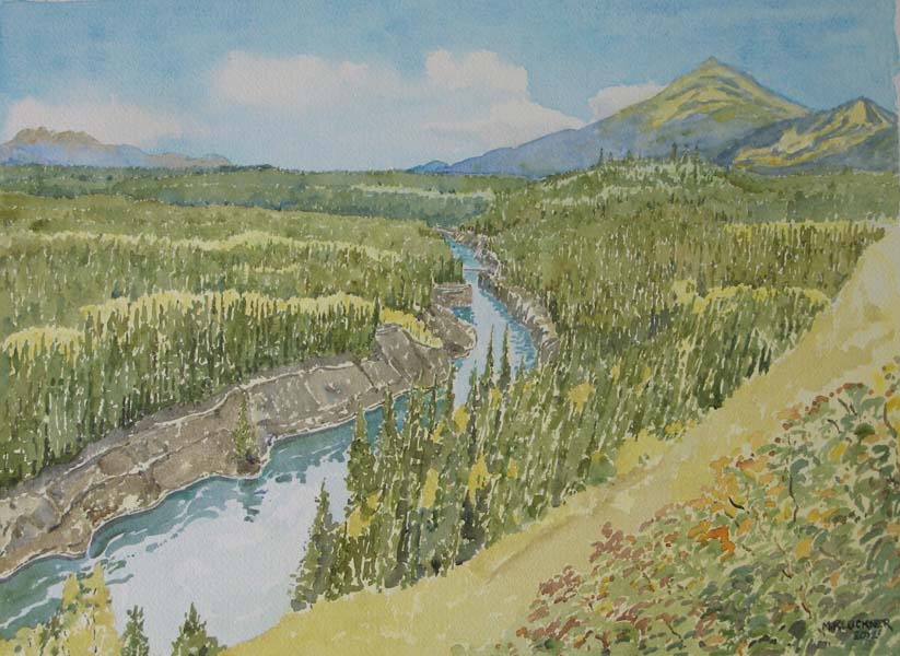
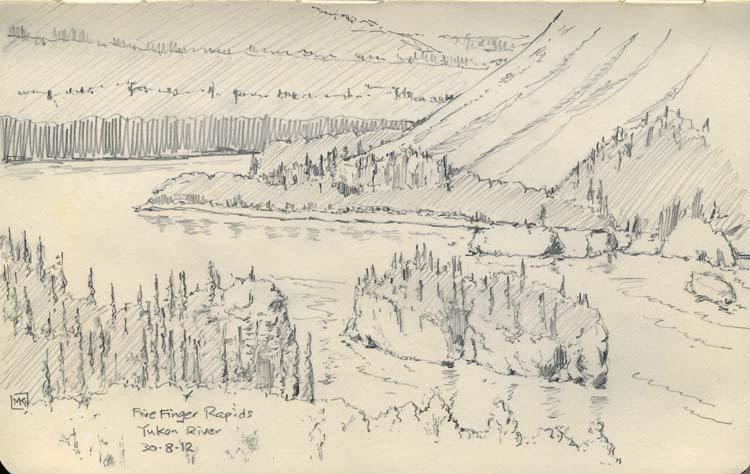
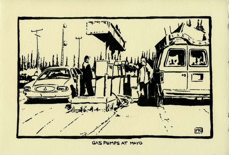
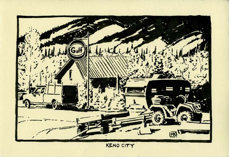
than float planes and their heroic bush pilots. Below: the trip through "The Communities" passes some fabulous landscapes, wonderful to look at but so utterly empty of humanity that you crave the little roadhouses and scattered homesteads. The view down onto the Five Finger Rapids is a highlight but the vistas from the hill above Pelly Crossing, and across the valley near Elsa, are classically "Yukon" because they seem to go forever in the clear air. Another thing about The North (not too different from most of western North America) is the way that development scars the landscape, dislodging the thin soil, which is often then covered in "stuff" – the detritus of rural life, like piles of boards, discarded appliances, ATVs and cars. Very picturesque! Gas stations, such as the one at Mayo with its convenience store, take on a huge significance; people fuel up and chat, reluctant to jump back into their vehicles and continue driving. The distances are immense: Whitehorse residents talk about two days to "drive out" – to Edmonton, the nearest significant city. You slow down for the "bump" signs along the highway, as the frost heaves can break a spring and toss your head into the roof of your car before you know you've done anything wrong. |
Pelly Crossing
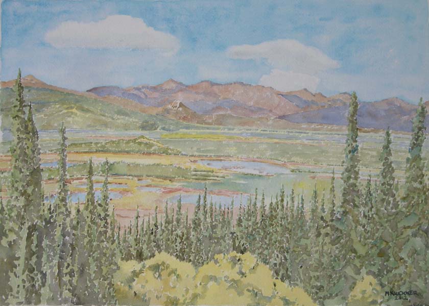
View from the old Elsa Townsite, marshy moose-pasture in the valley below....
Gas station closed, pumps grown over with birch saplings...
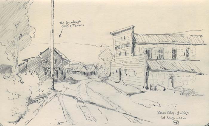
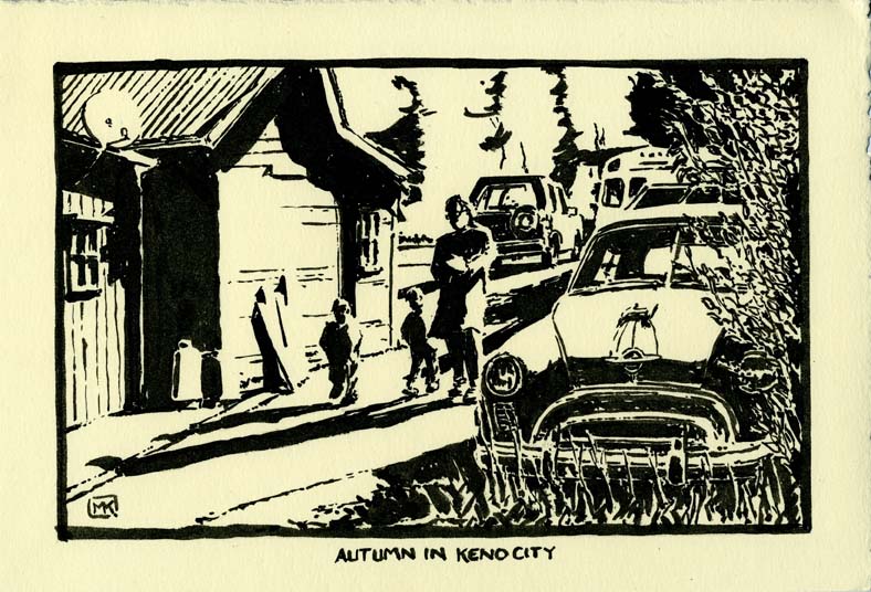
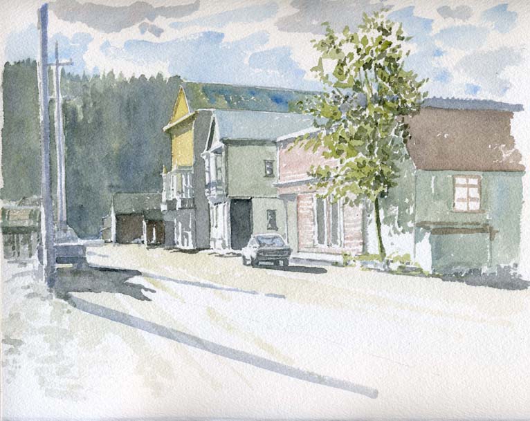
| The vintage buildings of Keno City are a highlight of any
Yukon odyssey. The former hotel, on the right in the sketch
above, is a bunkhouse with pretensions (its boomtown front).
Maybe a dozen people live in Keno City year-round, including one
retired miner dependent on his fellows for trips out (to Mayo,
if not Whitehorse) for groceries and everything else. The
rolling hills stretch away into eternity, a tapestry of low-bush
blueberries, kinnickinnick and fireweed that glows red in the
autumn sunlight. I'm not sure how much farther north the trees
continue before you hit tundra, but they're common here in the
valleys, scattered on the alpine slopes. Other necessary
elements for a Yukon portrait: satellite dishes, cutting
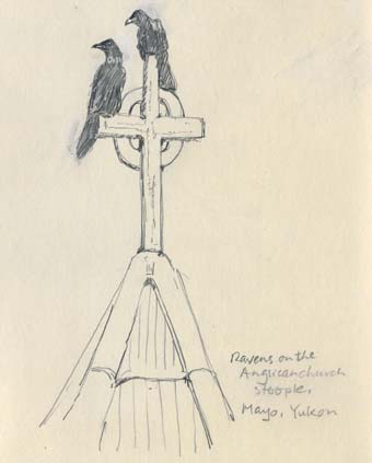
firewood for the winter, ravens that live there year-round.
|

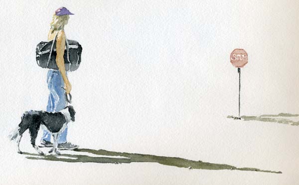
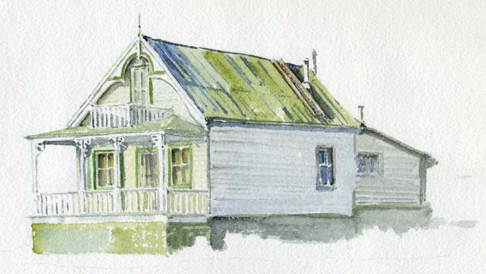
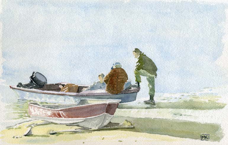
A century-old house (as of 2000), with all its Victorian trimmings still intact. Below: boats on the bank of the Yukon River.
Contact me Go to home page Return to main travel page
Artwork & text © Michael Kluckner, 2000 & 2012