Return to main Vanishing B.C. page Return to home page
This page last updated May 28,
2019
© Michael Kluckner
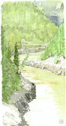
The old Alexandra Bridge, sketched from the deck of the new one in 2001
|
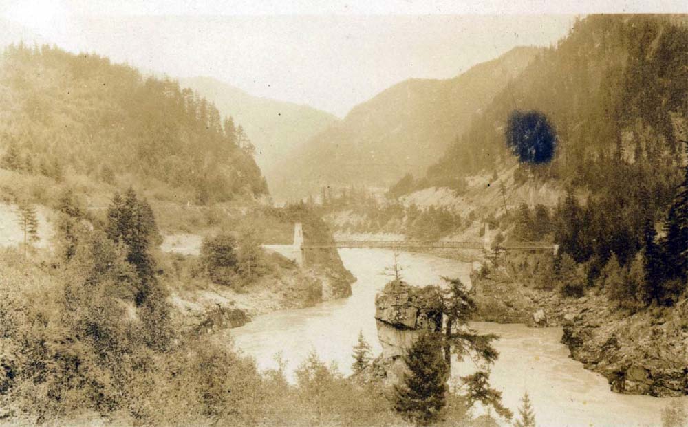
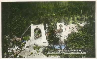
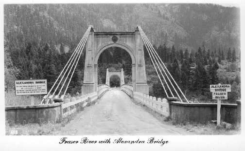
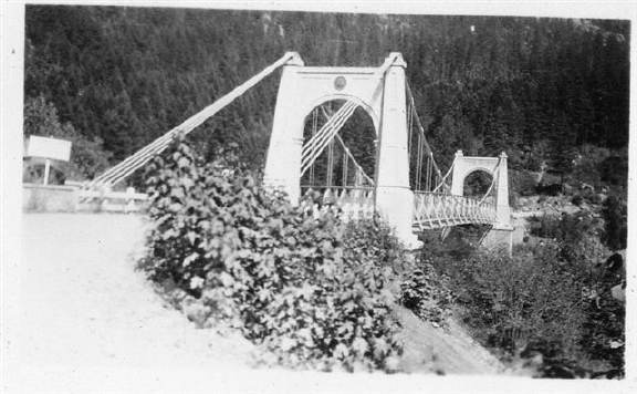
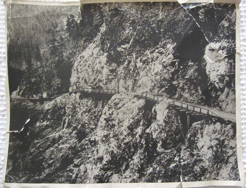
Both postcards probably from the 1940s. Top one by Gowen, Sutton Co. Ltd. Vancouver BC, photographer unknown; bottom one probably by J.C. Walker, Vancouver Written in 2003: The old (actually, the second) Alexandra Bridge, unused by vehicles since 1964, provides the last physical evidence of the scale of highways and bridges in the Fraser Canyon – indeed, on the Trans Canada highway in BC – in the 1950s and before. The bridge is accessible by a path, which is in fact the old highway, that winds down the hillside from the modern highway just east of the new Alexandra Bridge and almost within sight of the Alexandra Lodge. It is alarmingly narrow and, with its open-weave metal decking, not an experience for anyone prone to vertigo. The concrete in the towers is badly spalled and the cables are rusty but so far adequately strong. It will probably fall down soon and be declared unsafe, perhaps in that order, for no government has seen fit to pay attention to it by restoring it as a tourist attraction and perhaps tying it in with some of the surrounding historic trails and places like the lodge. As is the case throughout the Fraser Canyon, it has looked very shabby since the opening of the Coquihalla highway (#5) in 1986. Essential to the completion of the Cariboo Road, the first Alexandra Bridge was begun on June 16, 1862 and completed September 1, 1863.
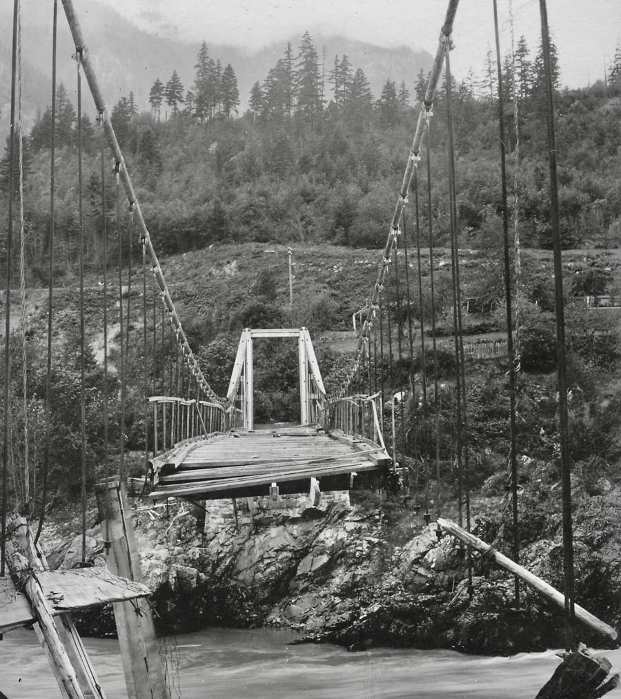
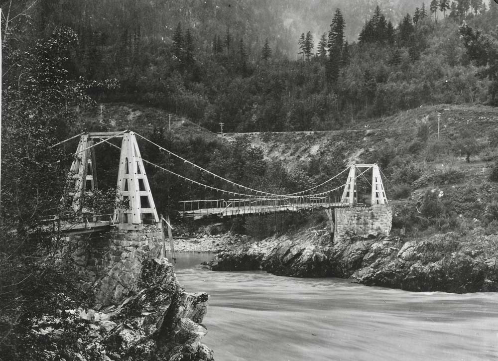
Photos below were taken in 1912 by Noble Smith, resident engineer for the Canadian Northern Pacific Railway (now the CNR) when it was under construction at that time and showing the deck washout remaining from the 1894 flood. (Collection of Gregory Butters). |
There are also photos by Noble Smith of Spuzzum
in 1912.
************
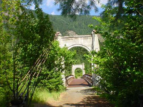
An up-to-date photo of the bridge, from the Spuzzum
side, by Penelope Allen, 2007
|
Note from Heather (above): Attached is a picture of the Alexandra Bridge taken by my grandmother in the 1930's. Her grandfather was Philip Jackman, a Royal Engineer.
From Thomas Mills, 2015: The photo above, from his website
page, taken at some point after 1926. From Audrey Nair, 2015: I came across your website while
looking for information on the old Cariboo Road. I came up
pretty much empty handed as it seems there are no maps online. I
first visited the old bridge back in the 80's then went back
last year when we moved back to Chilliwack. It seems to me like
someone would have started a restoration project to restore this
beautiful old piece of history but 22 years later there's just
more graffiti and a bit more rust:(
*** Sean Steede, in 2013, rode his motorcycle from Duffy
Lake to the Alexandra Bridge and made this video: On August 18, 2013, a new National Historic Site plaque was unveiled in Yale, at the corner of Front and Albert just above the Fraser River, to commemorate the Cariboo Road's 150th anniversary.
Note from Bruce Coughlan: I just discovered your site, and connection with Phillip Jackman. I have met a few members of the Jackman clan and am fascinated by his life story. (I used to live on Jackman Road in Aldergrove) I have written a song about Phillip Jackman entitled "The Last of the Royal Engineers." If you have any anecdotal info on Phillip Jackman RE, please let me know. Note from PK Jackman, 2010: I am the great grandson of Philip Jackman, Royal Engineer, founder of Aldergrove, first policeman in New West., etc. - I drove the old Fraser Canyon hwy in a Model A when the wooden bridge structure were still in place, that hung out over the river. When I was a young wet kid, an old timer told me when Trutch built the first Alexander bridge, it was designed to hold twelve tons and when finished, he loaded 12 tons of rock on the wagon and drove it across the bridge to ensure it would hold 12 tons. |
Fraser Canyon Motoring . . . .
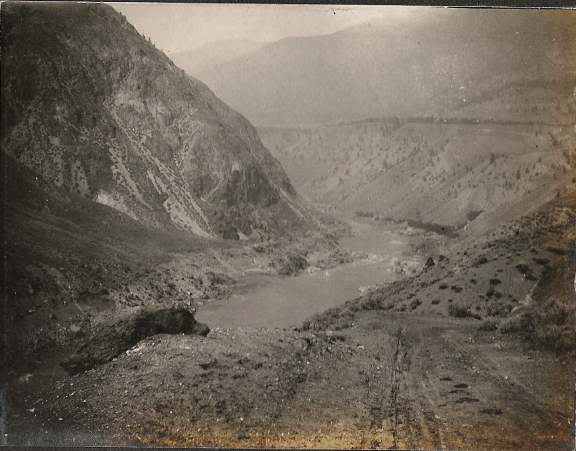
The upper Fraser Canyon near Lytton, photo by Richard Clarke on a roadtrip from Walhachin, 1912
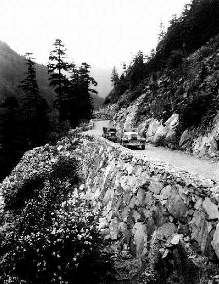
"Cars on the road between Spuzzum and Lytton," photo
from the late 1920s by A. Curtis. BC Archives A-04683
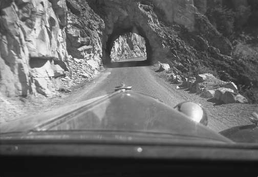
Tunnel in the Fraser Canyon, 1946. Photo by Ken Sigfusson
|
From Susan
Marles: A photo of the Fraser Canyon highway in 1948. My
father, Doug Willis (later of Willis and Cunliffe Consulting
Engineers), was the chief surfacing engineer for the dep't of
Highways, he was one of the engineers who surveyed and
designed most of the postwar B.C highways and some major
bridges during the period 1948 to 1964.
Conversation with Doris Tuohey, 2002 who first travelled up the Fraser Canyon in 1929 and spent a lot of time in the 1930s and 1940s goldpanning and vacationing. She recalled that in the 1930s the Alexandra Lodge was run in a very elegant style by a couple – she Irish and pipe-smoking, he a "well-educated Englishman" – whose names she's forgotten. She recalls white linen cloths on the tables and filet mignon on the menu. The road was terrible, and on the first trip her father got as far as Lytton and decided to have himself plus family and car shipped back to the coast on the CPR. She learned gold panning from a prospector who had a cabin near Hell's Gate and worked on the roads during the winter. Another spot she stayed during those years was near Siska in a "good colonial house" away from the road and run by a couple named Lindsay. This property had a good restaurant, several acres of grounds including an orchard, and a number of cabins for rent. Mrs. Lindsay was an artist and illustrated her husband's children's books, one of which was called Mouse Mountain. * * Email from "Diana", 2004: This was taken from my great-grandmother's obituary in January 1948. "Mrs. Christian came to British Columbia 67 years ago, travelling from her home at Ludington, Mich., via San Franciso, to Victoria and from there to Yale by paddlesteamer. From Yale to Savona she travelled by stage coach over the historic Fraser Canyon Road. The coach was driven by Fred Tingley, brother of the famous "Whip" Steve Tingley. From this point she left for Tranquille by lake boat. Then again she went by stage to the Greenhow and O'Keefe homesteads. Here the month-long journey was broken for a few days' rest. Mrs. Christian, then Emma Genia, was joined at this point by her fiancée. The journey was completed to Okanagan Mission by team and wagon." * * From Grace Darney, 2004: I recall my dad saying that during the 1920's and 30's they travelled down from Williams Lake to go to ballgames "At The Coast" (I always pictured these words capitalized). He said they travelled at night so that they could see another vehicle's headlights blinking through the bushes. One of the vehicles would pull over in the first place available, to let the other go by. Thinking about it now, I don't know how it was determined which car had to find a spot to pull over. [MK: Reading this, I'm reminded of the Coquihalla road in the 1970s, which was maintained to aid with pipeline maintenance and had that narrow, peer-through-the-trees, gravel road quality of the Fraser Canyon in an earlier era.] |
|
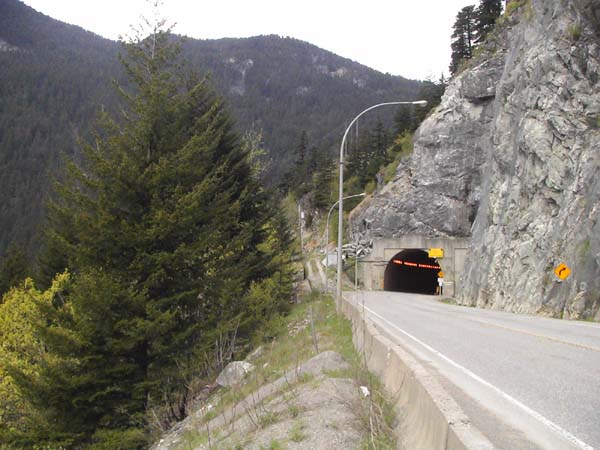
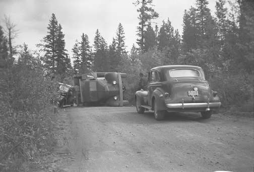
Truck accident on the Cariboo Road, 1946. Before being purchased by the Sigfussons, the Buick belonged to Mrs. B.T. Rogers, the widow of the owner of the BC Sugar Refinery in Vancouver. Photo by Ken Sigfusson *** From Milestones on the Mighty Fraser, published in 1950, by C.P. Lyons: (He gives an estimated driving time of 4 hours from Vancouver to Boston Bar.) "During 1883-4, the gigantic task of building the CPR through the Canyon caused great damage to the famous wagon road. Crossings were numerous and often the cuts or fills for the railroad grade jeopardized the road. Before the railroad was finished, in 1885, the bulk of north-bound freight moved over its lines to Ashcroft, where a new freighting and stagecoach headquarters was set up. "Gradually, the historic old road fell into disrepair and its almost total abandonment was hastened by the great flood of 1894, which washed away much of the trestle work used in skirting the cliffs and bluffs. Then, until 1915 and the advent of the CNR, the CPR became the sole means of transportation. "With the increasing use of the automobile after World War I, it was apparent that a road once more would have to be built up the great gorge. With two railroads already nitched into the rocky walls and taking full advantage of whatever low terraces there were, the survey of a road was no mean task. The survey started in 1920 and led to the construction of newly located sections four years later. The highway was completed to Lytton in 1926, and, after a one year interval, the connection was made to Ashcroft. Now a new highway is being built to conform to Trans-Canada standards." (The "new highway" occupied the Social Credit government of W.A.C. Bennett, and its Highways Department led by "Flying Phil" Gaglardi, from the 1950s through the mid-1960s.) *** From Benny Hill, who is documenting extant portions of the Cariboo Road, 2011:Here are my three main photo-sharing sites: http://www.flickr.com/photos/53004608@N06/sets/72157625096098988/ http://www.panoramio.com/user/4873126 For Google Earth. http://www.facebook.com/media/albums/?id=100000720057222 Cariboo Road 1, 2, 3 and 4. They only allow you 200 photos per set. Notes and photos from Benny Hill, who is documenting extant portions of the Cariboo Road, 2009 & 2010: 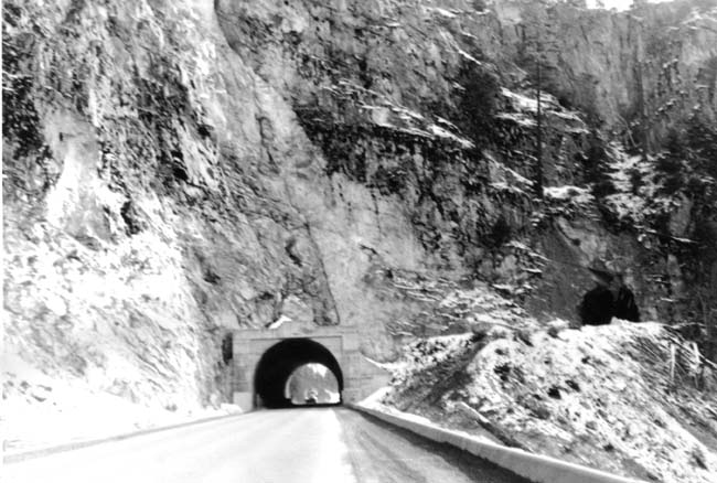 A photograph by my grandfather about 1970, showing the 1960 Hell's Gate Tunnel with the older one on the hillside above. This is the east portal facing West. 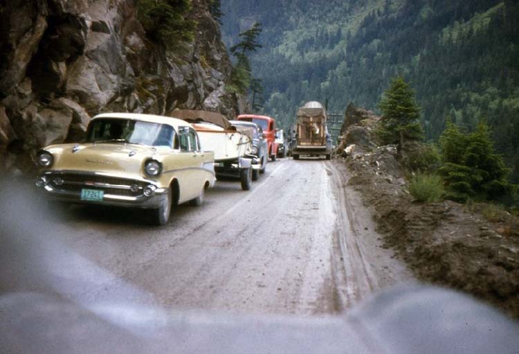 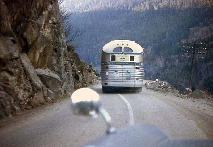 Photos taken before the China Bar tunnel opened in 1961 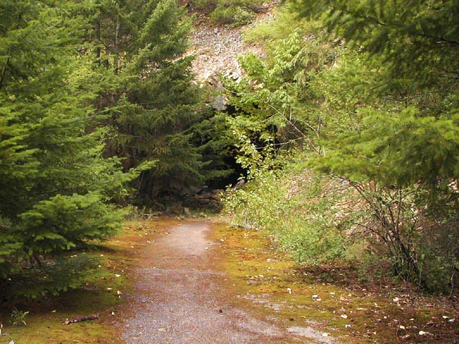 This is the old Hell's Gate tunnel today. West portal looking East. Taken by the bend. This is the safe side to access the Hell's Gate tunnel, by the 'Elvis Rocks the Canyon' café. 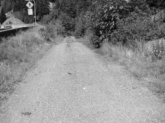 This is at Anderson bridge between Boston Bar and Lytton, with the modern highway on the left. Obviously there used to be an old trestle-type bridge in the distance.
The old highway at China Bar
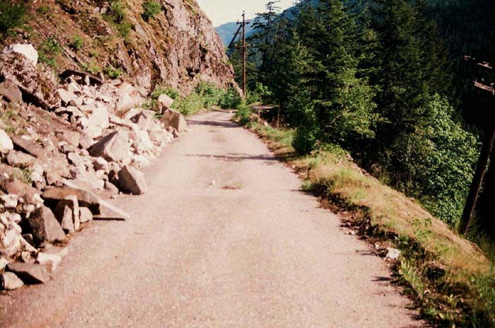
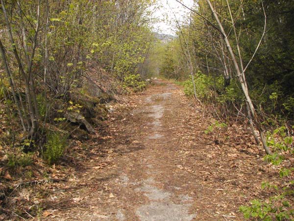
Part of the Cariboo road near Alexandra Bridge
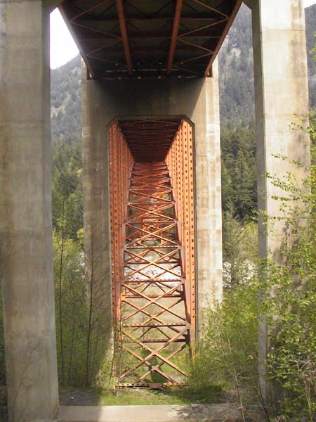
Under the deck of the new
Alexandra Bridge looking towards the Alexandra Lodge side
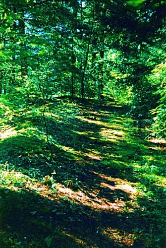
The old highway, looking
toward the old bridge from a spot near the new one.
The old bridge
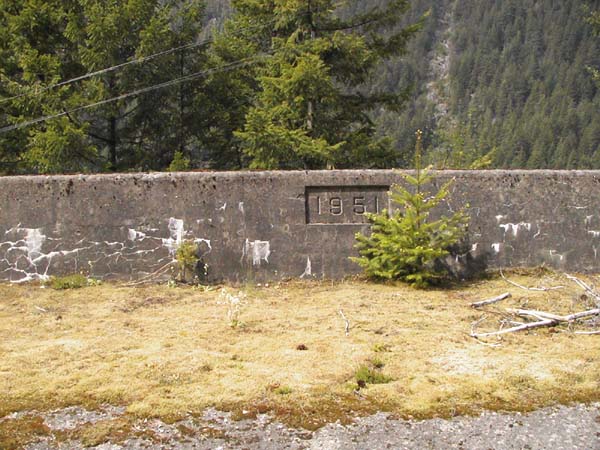
Two photos from near the
Alexandra Tunnel: above, the concrete retaining wall. Below:
"Cariboo Road at Alexandra Tunnel near the safe place to pull
of the highway. There is a larger place to pull off a couple
hundred yards West of here. You can see both Alexandra bridges
from here." -- Benny Hill.
[end of the Benny Hill photos and captions] * * * My own (i.e. me – Michael Kluckner) childhood trips to our summer cabin on Shuswap Lake always began with a muster by mother to report for breakfast in the grey pre-dawn light of our Vancouver neighbourhood. The car had been packed the night before, leaving enough room in the trunk for food and enough in the back seat for the huge numbers of comic books my brother and I required. My aunt, who worked for the diagnostic centre at the Children's Hospital, arranged a steady supply of comics, all with their covers ripped off, superfluous to her needs at work. The smell of our goods and food in the open car trunk, inhaled deeply, signalled the beginning of the great adventure. In the earliest years, in the late 1950s, we drove east along Marine Drive, through New Westminster, across the Pattullo Bridge and along the Fraser Highway, delayed at every little town and crossing, before arriving at the open road past Langley. When the Deas (now Massey) Tunnel opened in 1959, we began our trip heading south along the new Highway 99, then swung off at Highway 10, heading east through Surrey and Langley to the Fraser Highway--this saved about an hour. It was probably 9 in the morning, and usually raining, by the time we reached the "Gateway to Holidayland" carved log at Hope. From there, the road climbed gradually up the Canyon, passing Yale and, at Spuzzum, wound down the hill toward the Alexandra Bridge. On the east side of the bridge, we always pulled off to the side of the road just before Alexandra Lodge for a snack. Coffee for the parents, juice (I think) for my brother and me, and a peculiar pickle spread on crackers that my mother only bought for that particular snack and that I've never tasted since. The rest of the trip through the Canyon, with all the delays and the terrifying single-lane stretches along the edge of the gorge (before the tunnels all went in by the early '60s) we spent buried in comic books in the back seat. For lunch, we always pulled off the highway past Cache Creek at a narrow roadway across a cattleguard into ranchland, where we usually ate sandwiches and hardboiled eggs undisturbed. Once, however, the ranch boss and a couple of cowboys came by on horseback; it was alright if we ate there, he said, but told us, "Don't leave no scraps," a grammatical construction we knew to be deficient. Finally, after 8 or 9 hours of driving, we would arrive at Shuswap in the late afternoon. Post-1964, with the opening of the freeway through the valley and all the improvements to the Fraser Canyon highway, including the completion of the new Alexandra Bridge, we ceased to stop at the old places, the trip only taking about 6 hours or so. It now takes about 4 1/2 or 5 hours to reach Shuswap Lake from Vancouver. |
|
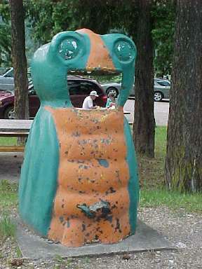
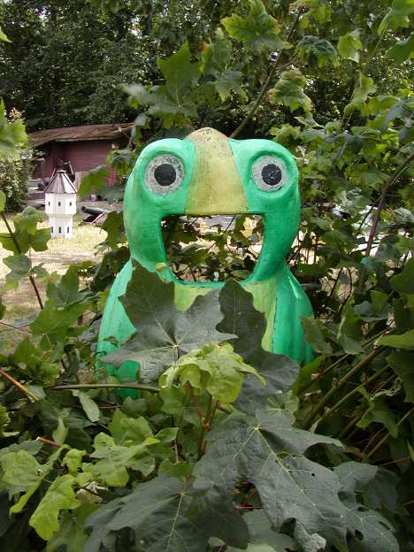
One of the last Garbage Gobblers, photographed in 2003, a BC Centennial (1958) icon that once dotted the roadsides of the province, in front of Ashcroft Manor. Sensibly they have gradually been replaced with bear-proof can holders.
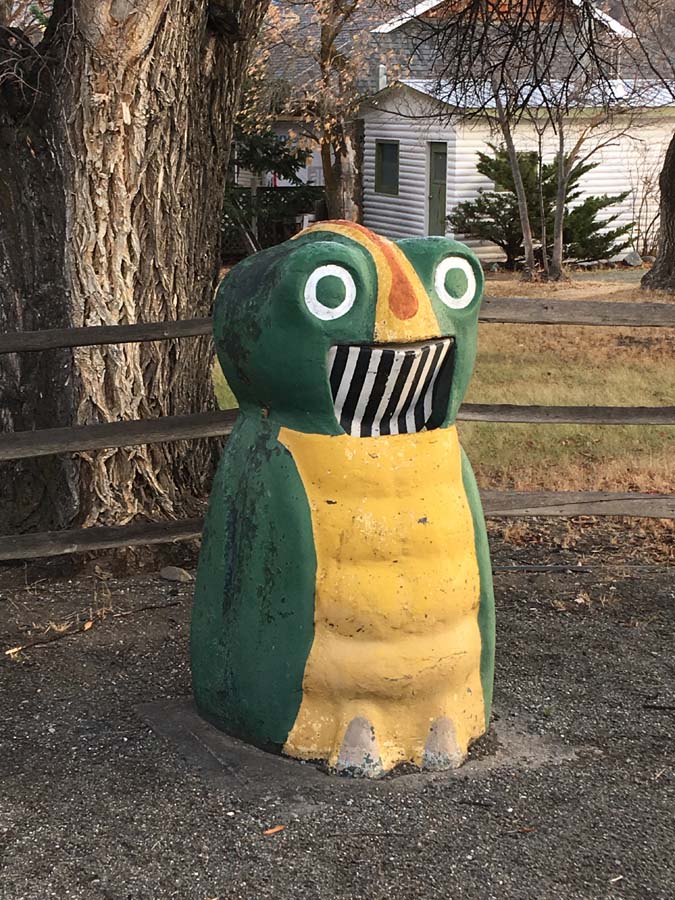
Garbage Gobbler #2, in need of historically accurate paint and new teeth, at the Birch Island rest area north Clearwater, June 2003. * *
|
|
From Scott McKenzie, 2017: A
couple of recent shots of the Garbage Gobblers at McLeese Lake
(behind the fence) and Ashcroft Manor. There is a third at
Slim Creek that I will try for a photo of.
From Barbara Roden in Ashcroft, 2016: Just an update on Garbage Gobblers: my son, who now lives in Prince George, was travelling down to Ashcroft for a visit on December 16, and when he stopped in Williams Lake phoned me to say he’d spotted an original Garbage Gobbler at a site (he thinks a works yard of some kind) about a kilometre north of McLeese Lake beside Highway 97. Also, I did an interview with Transportation Minister Todd Stone a few weeks back (I edit The Ashcroft Journal newspaper). The story was about the revived “Stops of Interest” highway signs program, but we got talking about the Garbage Gobblers, and Stone said that they are back, albeit in a different format (they’re bear-proof rectangular cans that have been painted to look like gobblers). He said that when he asked staff what it would take to bring the gobblers back, they were thrilled at the idea.
From Barbara Roden, 2015: Regarding your
section about Garbage Gobblers, and the comment from Mairi
this year about being unable to find any: please let people
know that the Garbage Gobbler on Highway 1 at Ashcroft Manor
is still intact and accepting garbage. I remember the GGs from
my (rather too long ago) youth, as we drove from the coast up
to Okanagan Falls where my grandparents had a house, and I
always say hi to the cheerful chap outside the Manor when I go
past. The 2014 fire which consumed the nearby Beam Station
left the Manor and the Garbage Gobbler intact. I’m an amateur
local historian, and on the morning after the fire I went to
pick up my then 16-year-old son, a volunteer with the Ashcroft
Fire Department who’d been at the site all night. When I
picked him up, the first thing he said to me was “Well, we
saved the Manor and the Garbage Gobbler.” Which goes to show
he knows where my heart lies. ***
From Mavis Nolte, 2014: I took this about 1 year ago. It is in a park at the corner of Goldstream Avenue and Veterans Memorial Parkway in Langford. This is apparently where the original gobblers were made. From Mairi, 2015: I’m sorry to say I was
unsuccessful [at finding a Garbage Gobbler]. I had people
all over the province looking but the Garbage Gobbler seems to
be in short supply. I had this naive idea that somewhere
in the province there was a warehouse of old Garbage Gobblers
looking to be adopted. I was wrong! What I'm
trying to find now are the old forms. The original GGs
were built in Langford, BC, not far from where I live.
While the Langford Public Works yard has moved, I can't help
wondering what happened to the old forms. So far I
haven't found them. I also heard of a fellow who made GGs
for Expo '86. I haven't been able to track down that
individual or anyone connected to him. My understanding
is that those GGs were made in Aldergrove, BC. If you
hear of a Garbage Gobbler on offer, could you perhaps contact
me? My husband was thrilled when I told him about the
project and he was touched by all the people who helped me
along the way. Note from Matthew Baldwin, Planner, City of Langford, 2007: A Googleª search of the term 'garbage gobbler' took me to your webpage, and I thought that you may be interested to know that the City of Langford has refurbished a garbage gobbler, and we have, or will soon be installing this at Veterans' Memorial Park (located at the SE corner of Veterans Memorial Parkway and Goldstream Avenue) in Langford, BC, with a bronze plaque holding the following inscription: "Throughout the 1960s and 1970s, the Garbage Gobbler was a popular landmark at British Columbia's Provincial Parks and Information Points, for garbage disposal. A local product manufactured in Langford, the Gobbler was designed and created in the 1950s, by Len Shaw, for the BC Parks Branch. Originally made from concrete, and later with fiberglas, the Gobbler was fabricated in the Parks Branch workshop which was located on the present site of Veterans Park." Local residents, Marilyn (nee Shaw) Fuller initiated the project, and Ian McKenzie and Ken Fuller, volunteered their time to refurbish this sample of the original Garbage Gobbler. I hope that you find this information useful, and I hope that you will visit Langford some day to see our gobbler! *** 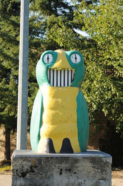
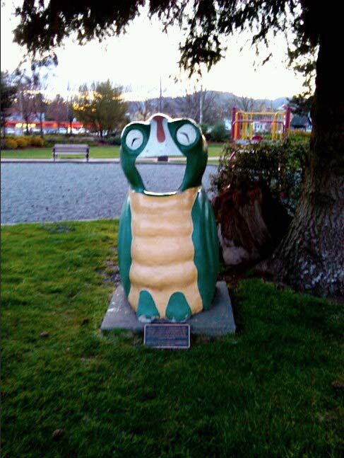
Note and photo from Diane Dunbar, 2005: I'd sure love to get my hands on this one or another one. I'd fix it up to its original colours though and somehow give him a mouth. Maybe you could just say he's from the Mid-Island area since he's actually in someone's yard. |