Contact me Go to home page Return to main travel page
| Desert to
coast -- a painting journey down British Columbia's Thompson and Fraser Rivers. Michael Kluckner The
large images below date from two journeys in 2007 &
2008, trips I made on visits back to Canada to set these rivers in my
mind
and sketchbook after moving
to Australia.
The thumbnails are from Vanishing British Columbia -- they link to the broader "roadside memory" text and historical images of that project. There is an extended text at the more links below The sketchbook is 10 x 11 inches, Arches cold-pressed 140#, so the double-page watercolours are about 9 x 22 inches Ironically, it was moving to Australia that focused my desire to complete a set of images and write some impressions of the splendid Thompson and Fraser river canyons of British Columbia... more The Thompson River
valley was once a place
of small orchards and fruit stands....
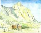
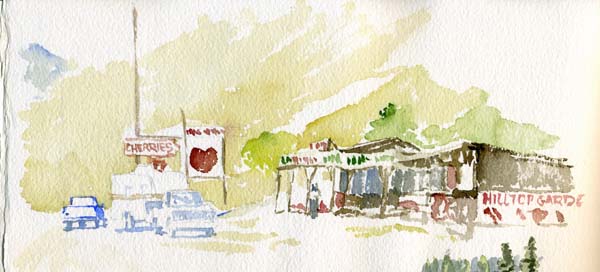 Travelling through, as most people do: Hilltop Gardens, the last of the fruit stands, as it was about 1999, across the Thompson River from the Toketic bench not far north of Spences Bridge... Tourists brake where cherries are displayed Beneath a summer sun that bakes The roadworn moms in bucket seats. Don't drink so fast they say-- Chilled cider cramps the throat. A fly in arabesques repeats Dark loops above sweet peaches. Just four hours to coastal beaches An island and a boat And a bistro with white wine. Eighteen-wheeler howls by, retread flapping. Leashed small dogs on roadside gravel crapping. One more DVD to watch ... The river flickers by. |
 The
river runs west from Kamloops Lake, then swings more or less south at
Ashcroft. First
(that is, farthest upstream) there is Walhachin, on the south side of the
Thompson midway between the lake and
Ashcroft, a beautiful valley once platted with young orchards but
destroyed by storms and the losses of a distant war. The
shattered dreams of a century ago.... The
river runs west from Kamloops Lake, then swings more or less south at
Ashcroft. First
(that is, farthest upstream) there is Walhachin, on the south side of the
Thompson midway between the lake and
Ashcroft, a beautiful valley once platted with young orchards but
destroyed by storms and the losses of a distant war. The
shattered dreams of a century ago.... |
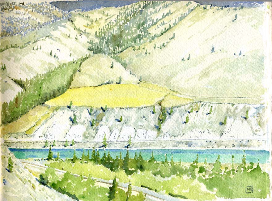
| July
'07: South
of Aschcroft, the east-side road -- that is, the one to Logan Lake --
climbs steeply above a wide valley so arid that no trees grew but for
one Ponderosa pine on a bend in the river. It had succumbed
probably to pine beetles, its needles still in the "red stage" -- the
first year of death. Sage
grey stage
Where shadowed evening sunlight plays. Sandals scratched by sagebrush, Blue jeans torn by thorns. Only goats could safely graze, Their mouths so tough their stomachs armoured too. Or cattle in the tender moistened spring? Ochre azur mix for chaparral, Skidding drybrush on the paper field. Paint it fast, for shadows swing Across the wind-blown forms, And in a sweep of cobalt frame The dying pine tree's transient flame. Orange will be grey next summer, One more colour gone. At this
point the
Trans Canada Highway is on the west bank of the river, following the
path of the 1860s Cariboo Road, crossing the valley beyond the first
set of hills that was once the
Cornwalls' Ashcroft ranch on its way west from Cache Creek, where the
Bonaparte River creates an opening northward to the goldfields.
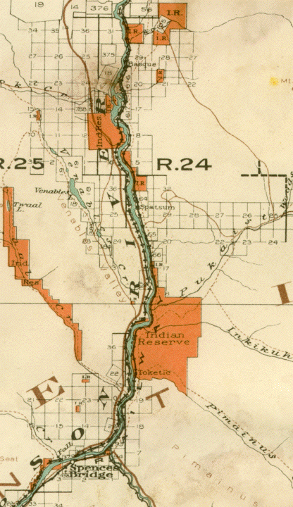
A rough dirt road branches off the Logan Lake Road and follows the east side of the river all the way to Spences Bridge -- I've tried it from both ends but have never had the vehicle to make it the whole way. The old map below, from 1914, shows the Cariboo Road on the left as a reddish-brown line crossing relatively open country until it is forced to hug the river edge near Spatsum. |
 |
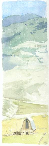 Barn
near Basque, horizontal logs on the bottom notched at the corners,
framed hayloft.
|
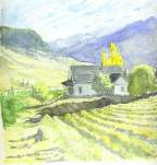
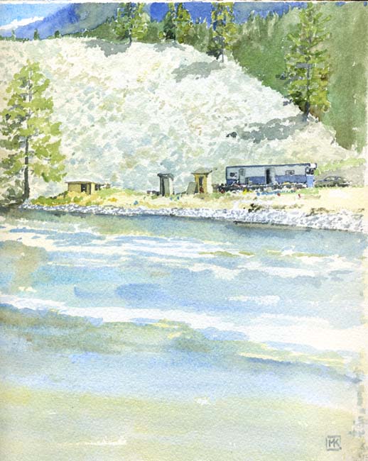
In the vicinity of Spences Bridge there are, or were, homesteads of the most typical BC character -- a few old places well-built, some shacks and many single-wides. Some of them are First Nations properties, and the two churches visible from the highway, both Anglican, both modest and a century old, are on Indian reserves. Only a few places have irrigation and still grow fruit. There are lush crops of alfalfa and hay, winter fodder for cattle and sheep foraging in the high pastures way above the river, on the river flats near Basque. But further south there is an air of abandonment, at least the abandonment of enterprise, and of people making only the most transient, temporary marks on the landscape. To an outsider on the Trans Canada highway these seem to be subsistence lives lived in profound isolation. Abandonment, poverty and indifference. We who are the blood that Flows in highway one's wide vein From Van to Kamloops, Med'cine Hat Note the lonesome trailers, rusted cars Above the turquoise river's gravel bars. Where have the owners gone? Into what other lonely empty space? Their absence does explain The shrivelled lilacs left behind. Nothing beside remains, No planted tree to mark their place. |
 The Teit property, aka Hillside Gardens, the last of the fruit stands, mentioned above |
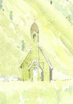 St. Michael and All Angels church at Spences Bridge. The other nearby church is St. Aidan's at Pokhaist. |
 An orchard and homestead south of Spences Bridge that was burned out in 2007. |
| July
'07: Dots of human activity... temporary marks on the landscape... Above: Homestead #1, Inkikuh Creek in the gully on the left. Below grey dotted hills A single-wide on dried-out bench above The white clay banks that slope above The CPR line just above The July turquoise river. 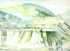 Right:
a 1994 watercolour of "Homestead #2" from Vanishing BC,
from the days of the red house.
Right:
a 1994 watercolour of "Homestead #2" from Vanishing BC,
from the days of the red house.Below: Homestead #2, the bench above the Thompson River at Toketic, Pimainus Creek in the gully on the left. A hundred in the shade. Once sheep cropped the ochre tabletop Then lushly irrigated. "May the folds be full of sheep And the valleys also stand so thick With corn that they may laugh and sing." Only gusty wind sings now And shadows stand in sagebrush folds. A single-wide remains and holds The memory of sun and snow Each melody the seasons played. I slouch beneath a wide-brimmed hat, Sunburning, quickly find some hue To capture air so flayed so clear. A gully full of dull green trees And yet not far away, Pines like scattered pepper grains -- The colours shift to blue. Viridian mixed with manganese The river in July. |
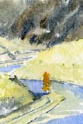
May '08: Homestead #3, on the south bank of the Thompson River a few kilometres downstream from Spences Bridge. Viewing someone's heaven from a raft-- A homestead on the riverbank A biffy and a plywood shed A generator, propane tank An airtight in the trailer. Mess and rusty metal spread Who cares? he might have said, You only see it if you wish. K-car in the chaparral Nearest store is Lytton Nothing left in Spences Bridge No one tells you how to live Next cheque he'll get a dish. Colours somehow rich but pale Dullness, distance Bright yet soft À point mais flou Shadows almost black What is that subtle hue? |
 |
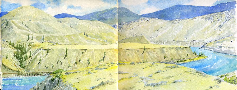
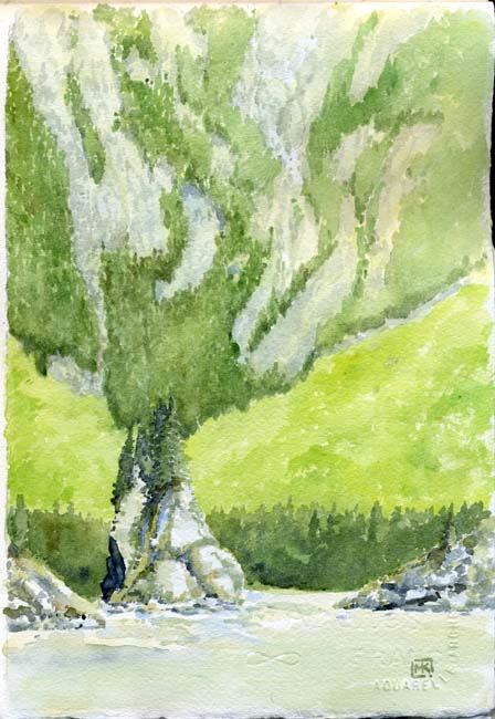
| May
'08: three
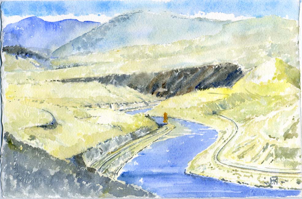
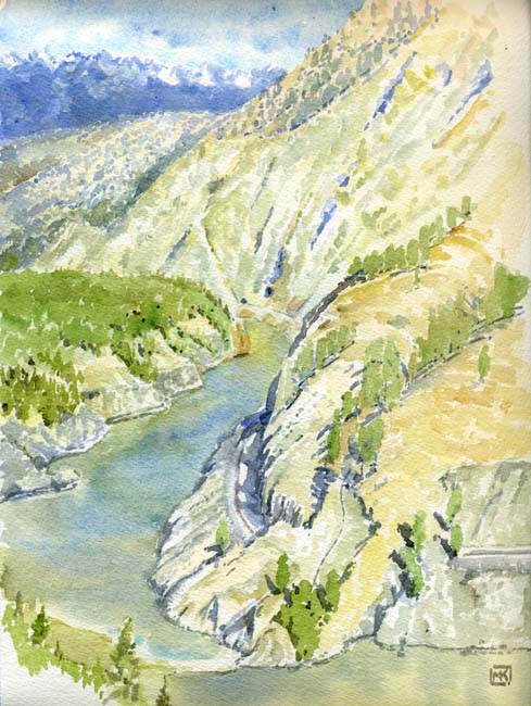
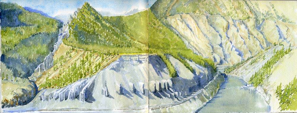
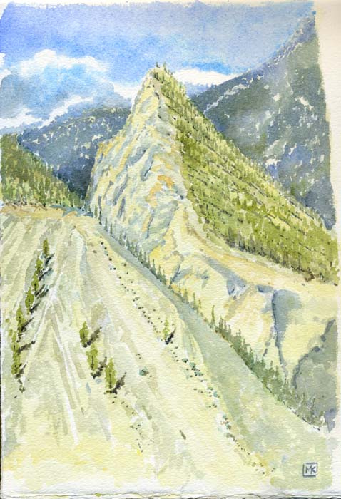
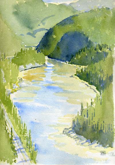
watercolours within a couple of kilometres.... Close to Lytton the Thompson River enters a dramatic granite canyon at Skihist. Along the highway, a small provincial park on a bench high above the river offers a respite for road-worn motorists. There's a cafe or two still at Lytton, but the first roadhouse stop to the east is a dark log pub at Spences Bridge, then nothing till Cache Creek or Ashcroft. In the summer, a handful of tourists exercise dogs and picnic at the few benches set up on the well-maintained, lush lawn beneath the Ponderosa pines. There's a metre or so of flat ground outside the chain-link fence that protects visitors from the cliff, a perfect place to sit and look down almost vertically onto the river and the CN line on the other side -- the CP line is straight below. Water milky silt-brown Springtime May month melt High sierra ultramar How far away is far? Roaring diesels pull and push Container-transport trade China Sea-Link Wal-Mart Can Tire Double-decker Struggle on the uphill grade. Across the river downhill coal cars Westbound glide to port Shrieking bearings, grinding wheels The canyon walls retort.... And so on. This view continues in the watercolour below.... During the 2008 painting trip to the Thompson, I went on one of the Kumsheen Resort's river-raft trips ... more |
 |
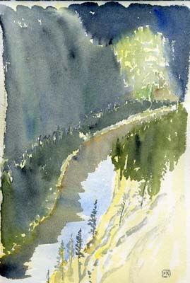
| Above: From the
bank below the edge of the highway, sitting on broken
rock and sagebrush thorns. The things we do for art.... Just
past the granite canyon the Thompson River runs between two benches
probably 100 yards high; the one on the right is untouched because CP
was able to locate its line on the bench, while the CN's line had to be
put just above the river level due to the sheer canyon
upstream. The cut ended up eroding the entire
hillside into a fanned-out delta of blue-grey sand and gravel exposing
a set of hoodoos. The dramatic triangular peak visible in both watercolours is separated from the adjoining mountain by the sharply carved canyon of Botanie Creek. I sat in the scrub on the edge of the parking lot of the highway diner just above Lytton to paint the watercolour on the right. |
 |
| At Lytton the Thompson River ends, mixing its blueness with the brown muddiness of BC's biggest river. From the edge of town you can see the blue plume spreading into the Fraser River like a puff of cigarette smoke in a half-lit room. And you can see the change... more |
 |
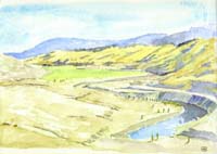
 July '07: early evening views from Jackass Summit looking downstream (left) and upstream (above), the blue gloom of evening's shadows cloaking the western slopes. All but the steepest banks are clothed in forest, still mainly pines but beginning to be mixed with the fir of the coastal forest zones, so different from the dotted Ponderosa pines and sagebrush slopes of the Thompson. I'd stopped at the viewpoint and was daubing away when a new Jetta with Nova Scotia plates pulled up. Young couple with two boys from Halifax: they'd been to Vancouver, bought the car and were heading home. No they had never seen a landscape as vertical, as precipitous, as this... |
 North
Bend, the CPR divisional point, used to be the most interesting village
in the Fraser Canyon but there isn't much left of its historic
underpinnings anymore. Most of
the population have migrated across the river to the CN
and highway side at Boston Bar. North
Bend, the CPR divisional point, used to be the most interesting village
in the Fraser Canyon but there isn't much left of its historic
underpinnings anymore. Most of
the population have migrated across the river to the CN
and highway side at Boston Bar. |
 |
 |
   Left: July '07, looking downstream to Chapman's Bar and the crossings of the two Alexandra Bridges. In the distance, the river narrows and increases its intensity at Spuzzum--the best spot to throw a bridge across the river to carry, initially, the Cariboo Road of 1862. The 3 places in this vicinity from Vanishing British Columbia are the Alexandra Lodge (top), the old Alexandra Bridge (middle) and the hamlet of Spuzzum (bottom). |
 |
 |
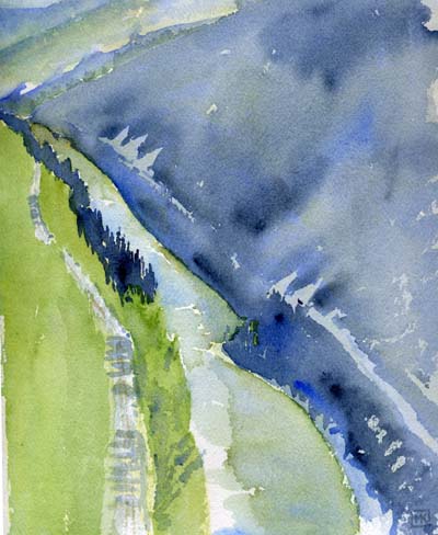
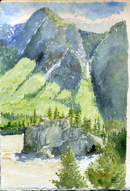
| May
'08: Lady
Franklin's Rock navigates the Fraser River's rapids just upstream from
Yale. It was the real barrier to steamboats heading upstream,
although the sternwheeler SS Skuzzy
did get hauled through the Spuzzum Narrows, then Hell's Gate,
in 1883, and plied the upper river for some years. "It was
named in 1861 to mark the visit of Lady Jane Franklin, widow of the
British naval explorer Sir John Franklin, who had disappeared in the
Arctic 16 years earlier." --Encyclopedia
of BC. The streaked landslides on the slopes of the mountains towering above the river make a surreal pattern on the backgrounds of the watercolours. Somehow dark-green fir cling to the steep slopes; below, the lighter yellow-green is deciduous alder. The river in spring flood is an awesome, powerful thing, flowing relentlessly, pulsing like a brown sheet flapping in a stiff wind.  Dark
green fir cling Dark
green fir clingEagle circling.... Yale, crouching in the green shadows of the narrow canyon, is the historic village at the lower end of the Fraser Canyon; unlike the upstream communities of Boston Bar and North Bend, it dates from the fur trade era. Ten years after its founding, in 1858, it became the end of navigation and staging area for miners wishing to ascend the Fraser River to the gold-laden sandbars. A handful of historic buildings are left now, including the Johnny Ward house. |
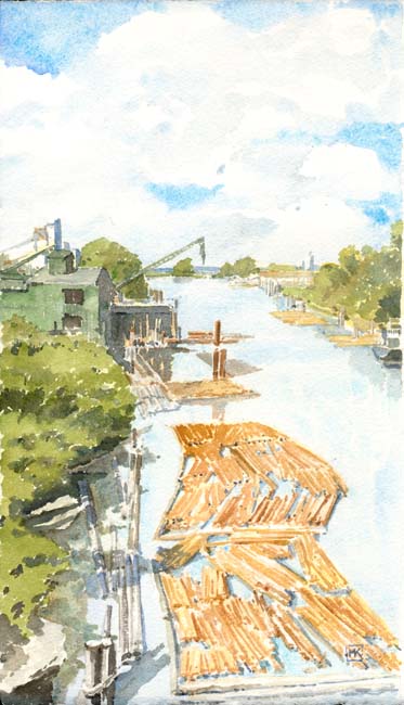 |
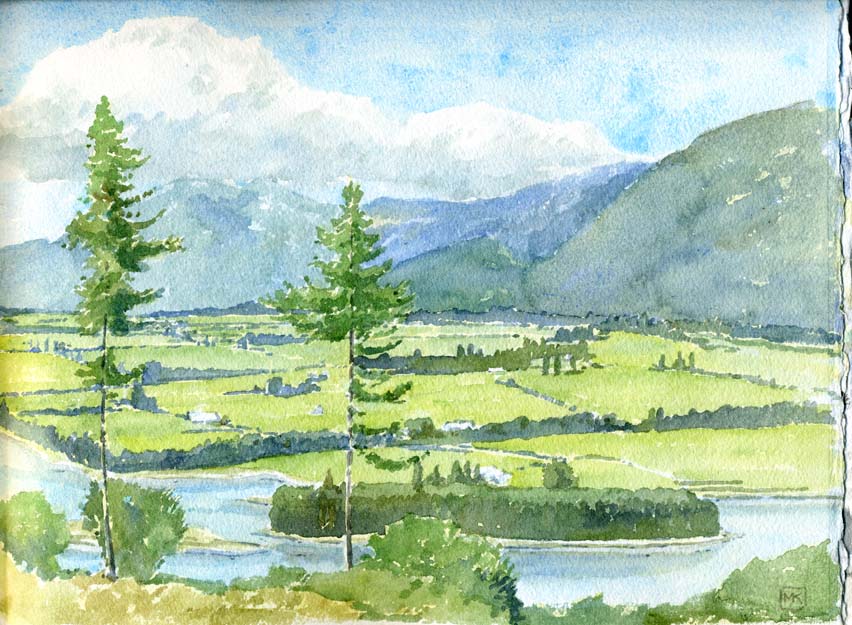
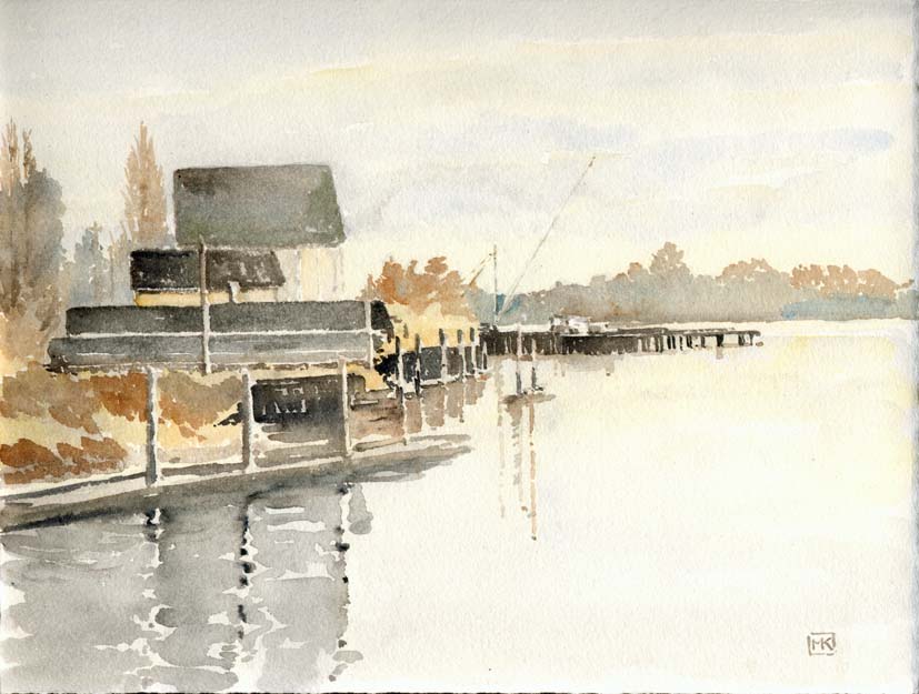
Above:
a watercolour from about 2004. The
pastoral Fraser Valley: the dairying north side of the river seen from
a spot partway up Chilliwack Mountain. The excitement's over... Left: the industrial Fraser River as it nears the coast. This is a 2006 watercolour I did for Vancouver Remembered. I stood on the Knight Street Bridge connecting Vancouver with Richmond and looked down onto one of the last of the old cedar sawmills on Mitchell Island. Below: along the Fraser River's north arm, almost within sight of the river's mouth. The old Celtic shipyard buildings, seen from Deering Island, look across to the distant bank of Sea Island -- the location of Vancouver International Airport. From this angle, the view can hardly have changed in a century. This is another watercolour from Vancouver Remembered. |
Contact me Go to home page Return to main travel page
Artwork & text © Michael Kluckner, 1994-2008