Contact me Go to home page Return to main travel page
Summerland & other paradises
2013
*
Michael Kluckner
| A trip with La Christina over some very
familiar countryside, for the first time in many years, in
beautiful late-September weather. Much of the territory was grist for the Vanishing British Columbia mill that occupied me from 2000–5, which I wanted to see again to find out whether the roadside bits had survived; I added a few new sketchbook pages, such as the log cabins at Wagon Wheel Ranch, to the material on the Boundary region. Another, more personal reason for the trip was to check out old camping spots and see whether the cabin we built in the mountains between Princeton and Summerland in 1982 had survived. That side trip is appended to this page here. |
 |
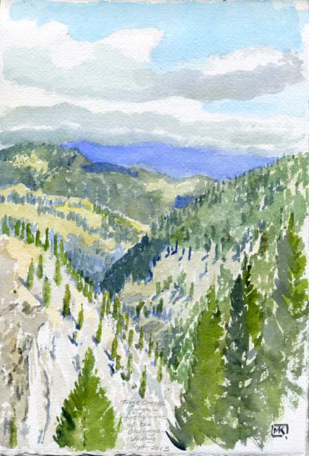 |
The Princeton-Summerland Road, locally known as the
Five-Mile at the Princeton end, follows the route of the Kettle
Valley Railway, ascending through the grassy meadows east of
Princeton, passing a chain of small lakes and, having crossed
the divide, following the route of Trout Creek downward into the
Okanagan Valley at Summerland. Trout Creek's canyon, including the rail line (now the Trans Canada Trail) drops way below the road during the descent toward the Okanagan. The first glimpse of the Okanagan Valley is not of the lake itself, but is evident because of the sudden blue shift, from the brown-blue hills in the middle distance to the far-off paler blue of the mountains on the east side of the lake. In other words, there's obviously a big gap in there.... |
2013
 2001 |
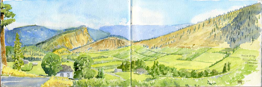
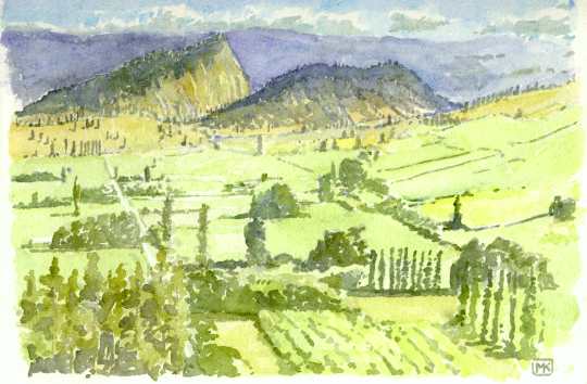
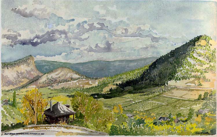
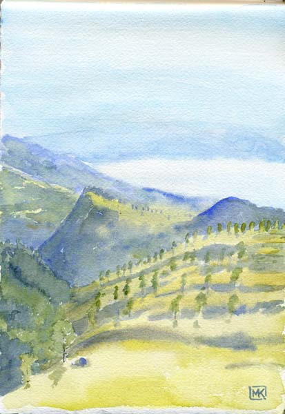
The view over Prairie Valley toward Summerland and the
lake is one of the most beautiful I've ever seen anywhere. I
keep painting it, feeling I haven't yet done it justice. It is the best combination of dramatic Okanagan natural scenery with the quilted patches of orchards and vineyards. There's a little information about Prairie Valley and Summerland in the Vanishing BC pages; the watercolour on the left was published in my book of the same name, while the one below from 1991 was published in my British Columbia in Watercolour in 1993. |
1991

| On Rutherford Avenue, in the middle of Prairie Valley,
the old house known as Balcomo Lodge is a reminder of the
gracious, well-financed quality of the some early Summerland
settlers. I first saw it in 2001 and sketched it in watercolour
for the Vanishing BC project; now,
it seems more overgrown, not exactly abandoned but just
lingering as a relic with the apple orchard planted almost to
the front door. Recalling Adam & Eve, without the nakedness
or the snake, we tasted apples overhanging the property line and
found them good, but were not cast out of Paradise, instead
moving on to a freshly-baked muffin of ancient grains at the
cool bakery on Main Street in Summerland's charming centre.
|
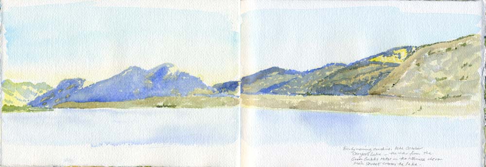
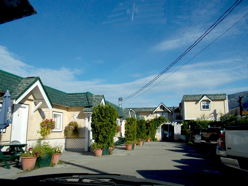
| Osoyoos Lake, early morning, from the
balcony of the charming, funky, probably doomed Green Gables
Motel, a favorite stopping place there over the years. The motel
is on the isthmus that Hwy 3 uses to cross the lake and is one
of the last examples of that kind of vintage, modest
accommodation in a town (and region) moving relentlessly toward
luxurious, wine-soaked resorts. My bet is, should I return to
Osoyoos in several years, that all will be demolished and there
will be little left that's affordable – certainly nothing with a
view like this one. |
 |

Wagon Wheel Ranch at Sidley, on the highway's climb to Anarchist Summit east of Osoyoos. See more on the Vanishing BC pages.
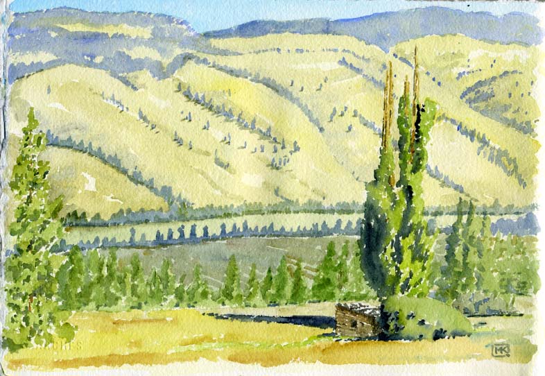
| Myers Creek Road heads south from Highway 3 just a few
miles east of Rock Creek and climbs upward through the grazing
lands and forests between the Kettle River (the blue line of
trees in the middle distance) and the US border. I wanted to
explore more but much of it seemed to be blocked off with
no-access and private-property restrictions. However, there was
this tableau of a ruined log building and poplar trees, similar
to the Charlton Ranch near
Bridesville, illustrating the truism that eventually, once the
abandoned buildings have crumbled, there will be only the
planted, non-native trees to hint that someone once had a life
there. |
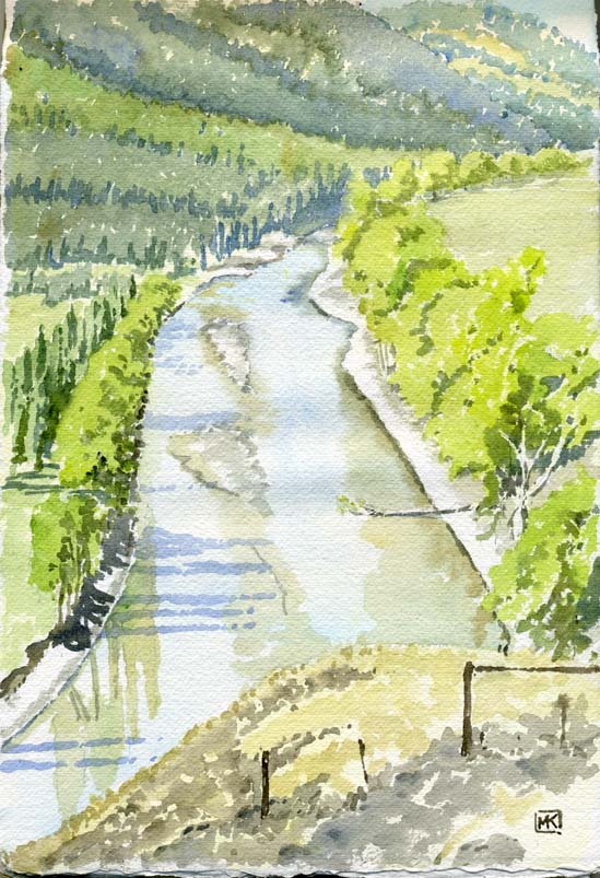
Low water on the Kettle River ... I sat on the roadside at the eastern end of the valley that begins at Rock Creek, just past Ingram Mountain Road (which provides a kind of access to the Weed House).
 |
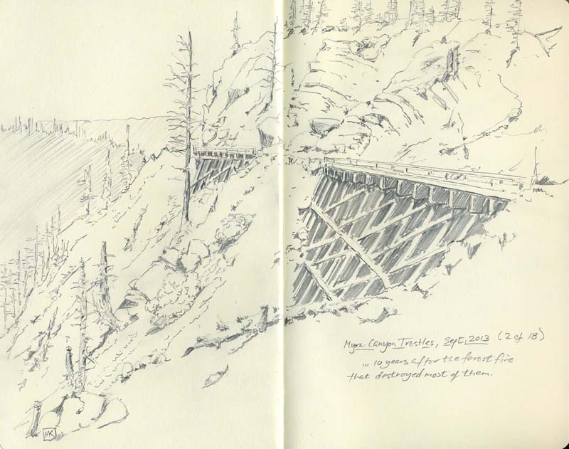
The fantastic first glimpse of Okanagan Lake from Highway
33, high above Kelowna, hints at the landscape the Kettle Valley
Railway had to traverse to cross the mountains between the
Okanagan and the Kootenays. The KVR had a main station at Penticton but only serviced Kelowna via sternwheeleers and barges on the lake. High above Kelowna, engineer Andrew McCullough created a miraculous set of 18 trestles to work the line around Myra Canyon; once the railway line was abandoned in the 1970s, volunteers worked to maintain the trestles and roadbed as a trail. It has become the number one tourist attraction in the Okanagan. In 2003 the disastrous forest fire that destroyed so many houses on the outskirts of Kelowna also burned several of the trestles. The government funded the rebuilding effort: read the saga on the restoration society's website. My page of Kettle Valley Railway info begins at Brookmere. Finally, on this trip, we got there, and walked 3 or 4 km. along the line and across several of the trestles, pausing just long enough for me to scribble the drawing below into the sketchbook. On another trip I'll take it slower, possibly be bicycle-powered and definitely carry the paints. |
The Old Cabin on the Five-Mile
| In the late 1970s, Christine and I
(sometimes with very young daughter Sarah Jane in tow) camped all
over the southern Interior, almost never in official campgrounds.
It was a period, which probably still exists for some people,
where a dirt track heading off a highway was an invitation, maybe
leading to a riverbank or a great view, and there so few people
around that you likely would have it to yourself. There were no
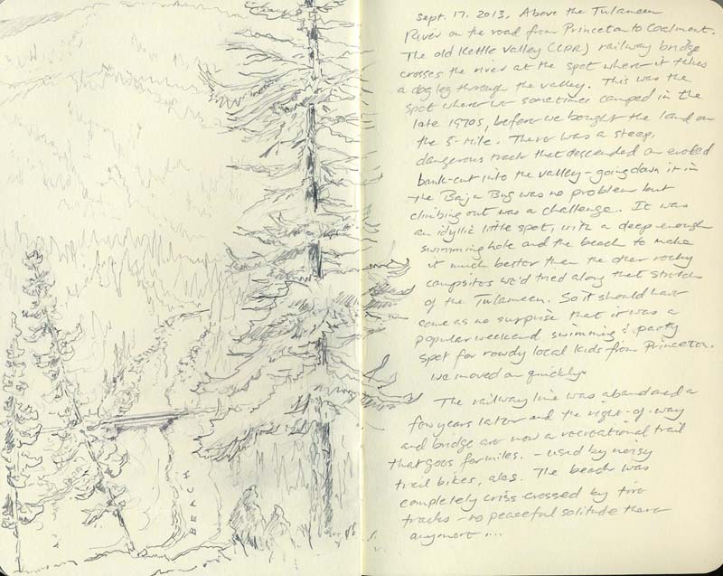
quads, few trail bikes. The woods were silent, the space infinite. One of our favorite places was the Tulameen River valley southeast of Coalmont – it was less than 4 hours from our home in Vancouver and there were a few places we knew secluded enough for several days of discreet camping. The one I sketched below on the bend of the river at the old railway bridge is very briefly visible from the road high above; it turned out to be a too visible paradise, too well known by the locals, and we only had it to ourselves once for a couple of days. However, there was another spot upriver, about a mile from Coalmont's store and pub, where we camped for a few years, and another, more secluded spot on the other side of the river near the Wright & Johnsen cabin. |
| A trip we made to Ontario and Quebec in the summer of 1981 set
us on a path to purchasing our own block of land. When we tried in
eastern Canada to find the kinds of little roads that led onto
Crown land or an unpeopled patch of riverbank, we were invariably
turned back by private property/chemin privée signs. However, back
in BC, we were thwarted in our attempts to buy a little piece
along the Tulameen River. It was all tied up in timber and grazing
leases, so we began to look further afield. On a trip in
September, 1981, we found an 8-acre lot along Siwash Creek on the
Princeton-Summerland road that ticked all the boxes: it had only
about 80 feet of frontage on the road but was very deep and opened
out in a pie shape, with a meadow of a few acres and 750 feet
along the creek. There was a good site on the bluff above the
meadow for a cabin. The following summer we set to work with a
chain saw and hand tools and built our masterpiece, 16 feet square
with a steep-pitched roof (snow load) and a loft for our daughter,
a woodstove for heat, a bush cooler of wet burlap over a tin tub,
water bucketed from the creek and an Aladdin lamp for the
evenings. The siding was half-log palisade scavenged from a nearby
sawmill site nailed over a standard 2 x 4 frame, all supported on
a grid of 8 x 8 posts. We kept it until 1989; I went back once, in
2001, and was pleased to see it was still there and in use. We decided to stop by on our way through to Summerland to check it out. |
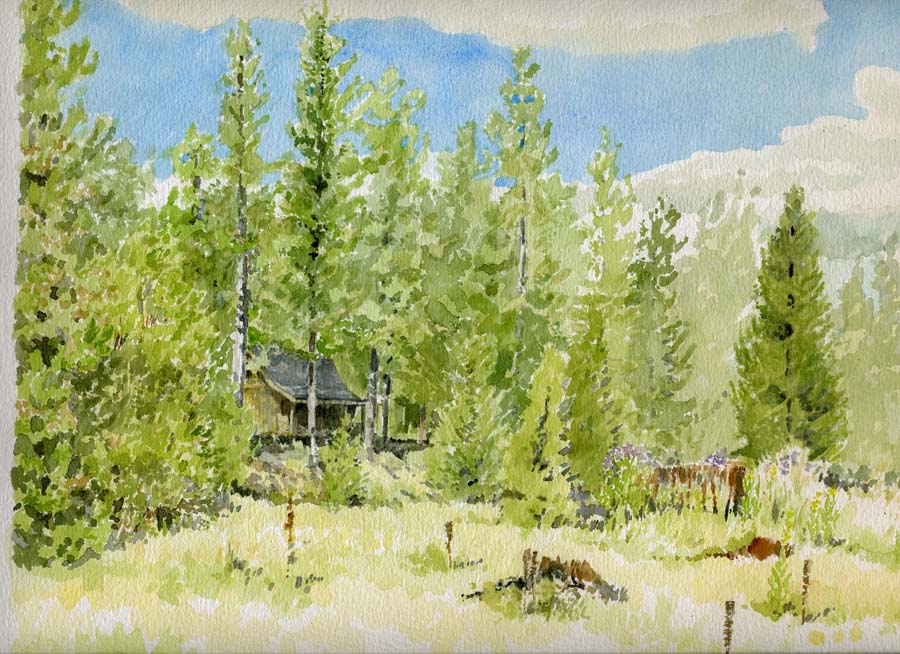
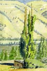
1989, from the meadow
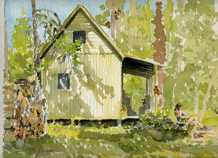
1988
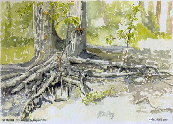
The three daubs below were reproduced in British Columbia in Watercolour in 1993
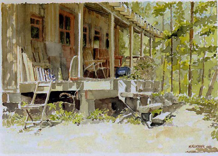
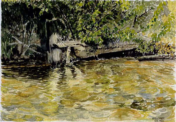
| 1989: the swimming hole in the creek (above). The
cottonwoods (below) held a sandbar together a bit further
upstream, forcing the creek around a dogleg and producing
another, shaded, swimming hole that was also a good place to
bury wine and beer for refrigeration. Recent spring floods have
wiped out the cottonwoods, pushing them way downstream and
straightening the creek at this point. |
... and, 2013 (photo by Christine)
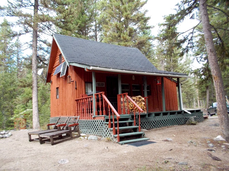
...almost a heritage building!
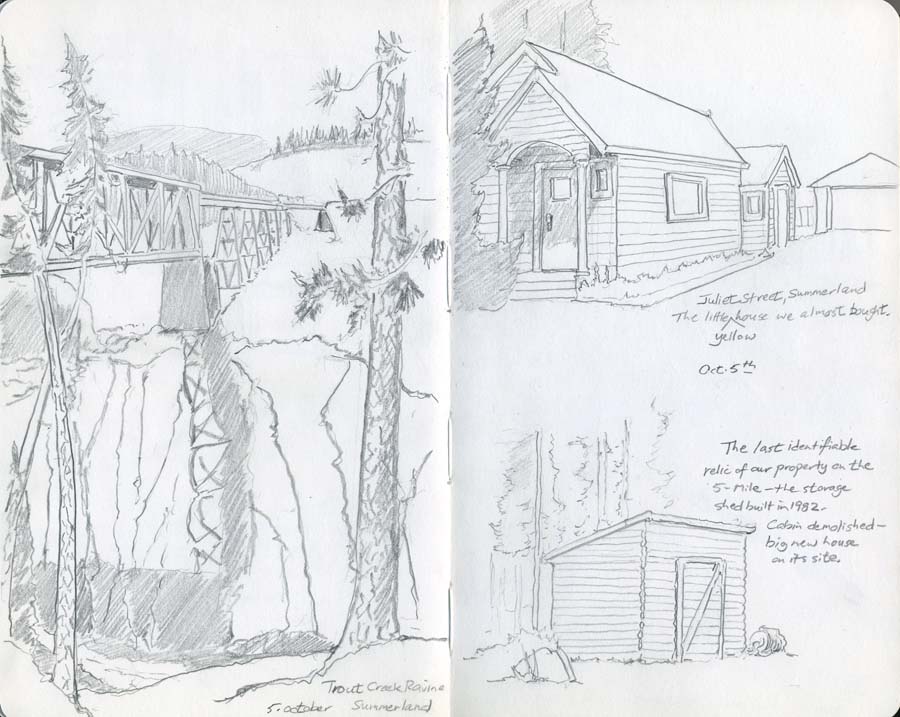
Update 2022: went by, found the cabin had been demolished and a big new house put on its site.
Only our little storage shed, the first thing we built in 1982, survived...
Contact me Go to home page Return to main travel page
Artwork & text © Michael Kluckner, 1994-2013